
From site data to finished estimate
Follow your project through the complete earthworks estimating process, all in one application.
Import
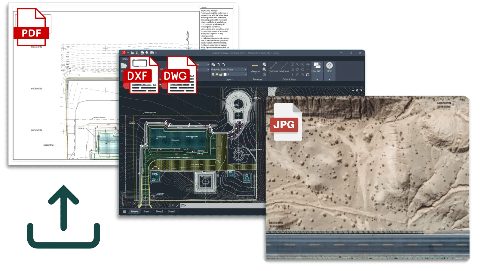
Bring your CAD, PDF or LandXML site information into Kubla Cubed.
Build
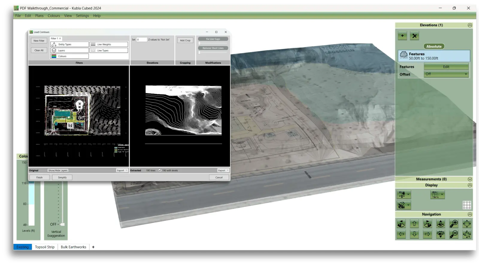
Create your existing ground, proposed surfaces and site phases.
Model
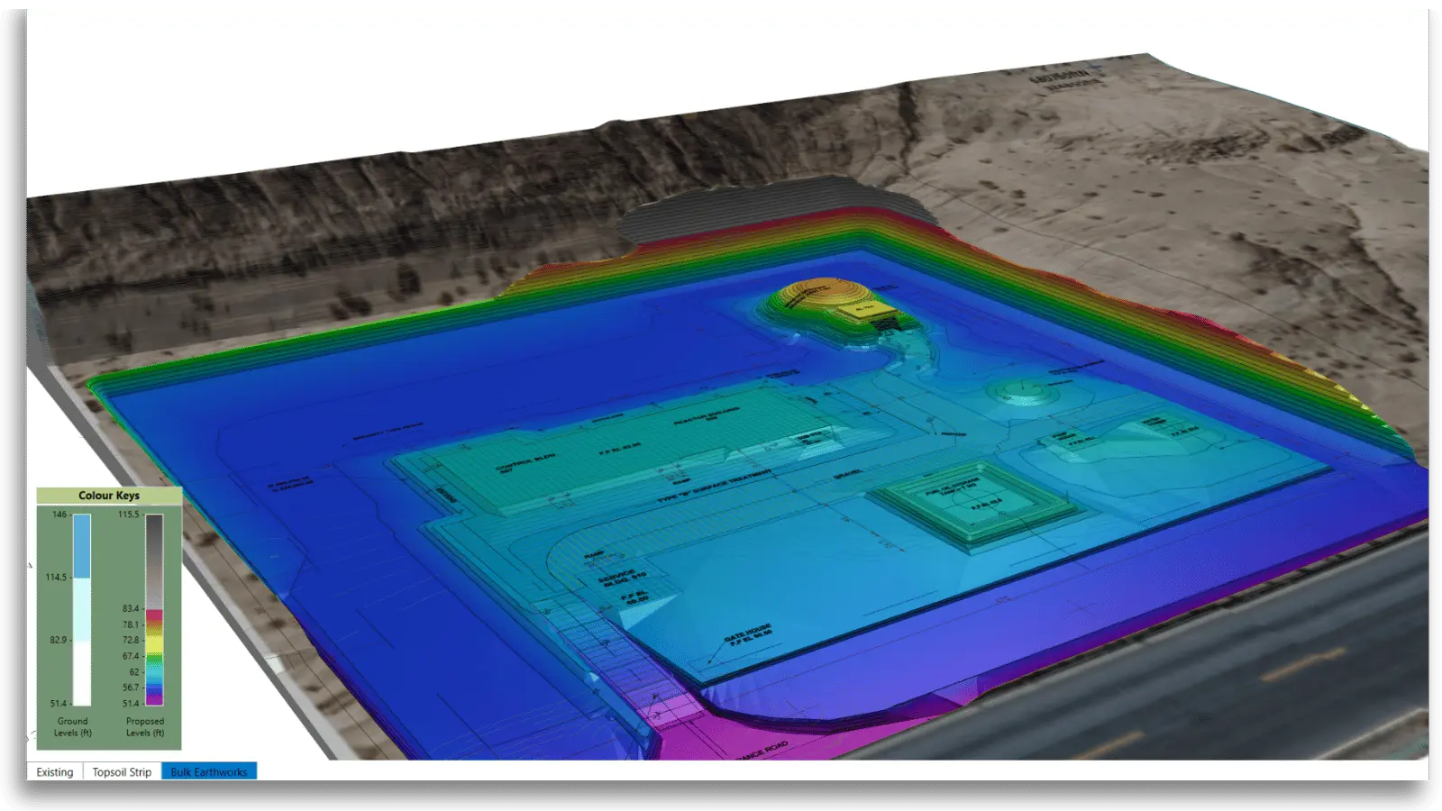
Define areas, formation levels, batters and other site details.
Calculate
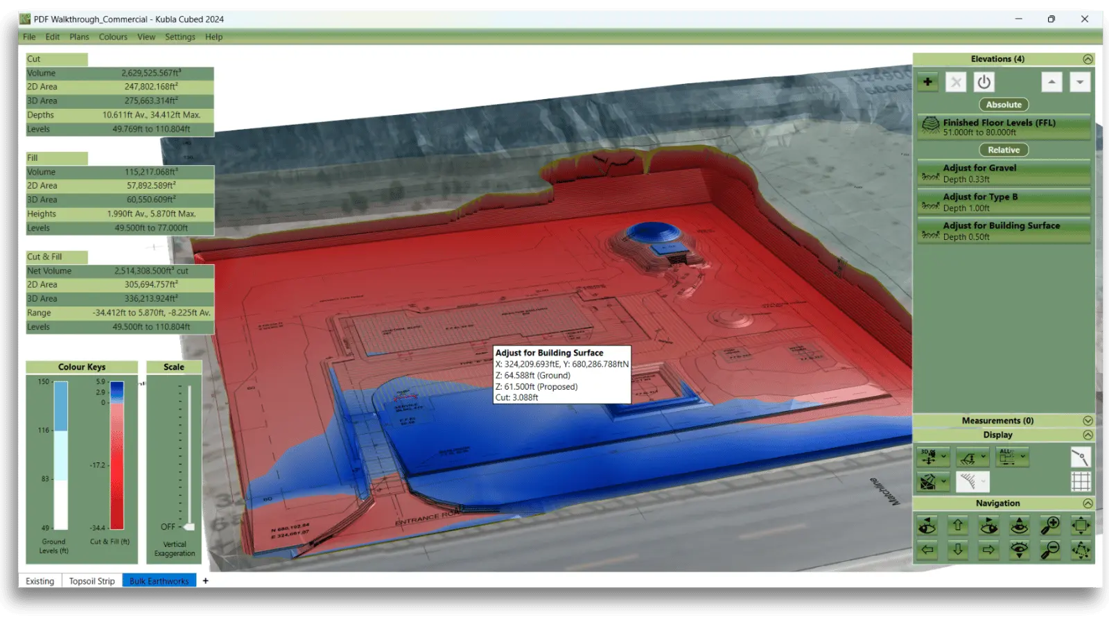
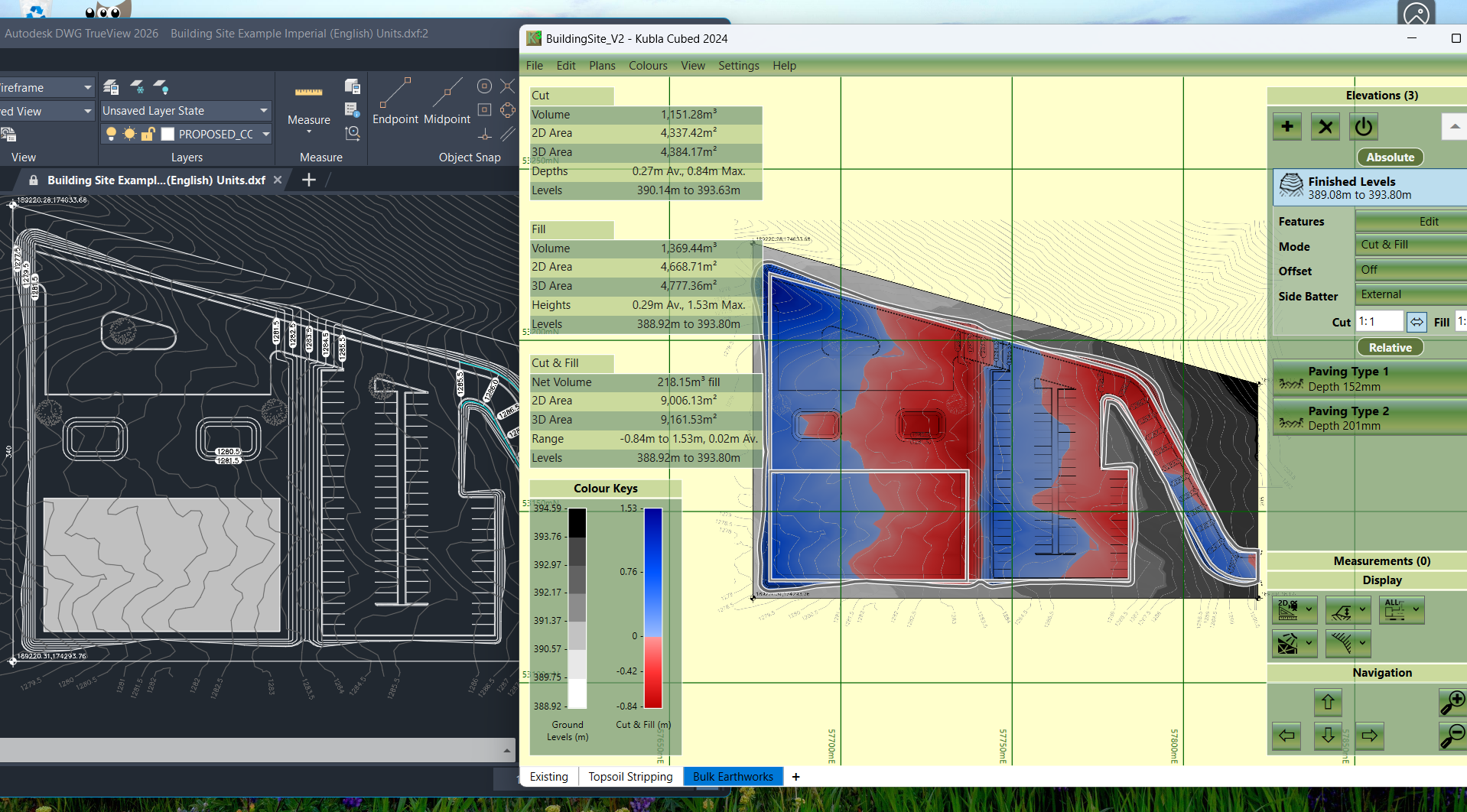
Calculate accurate cut and fill volumes for your project.
Export
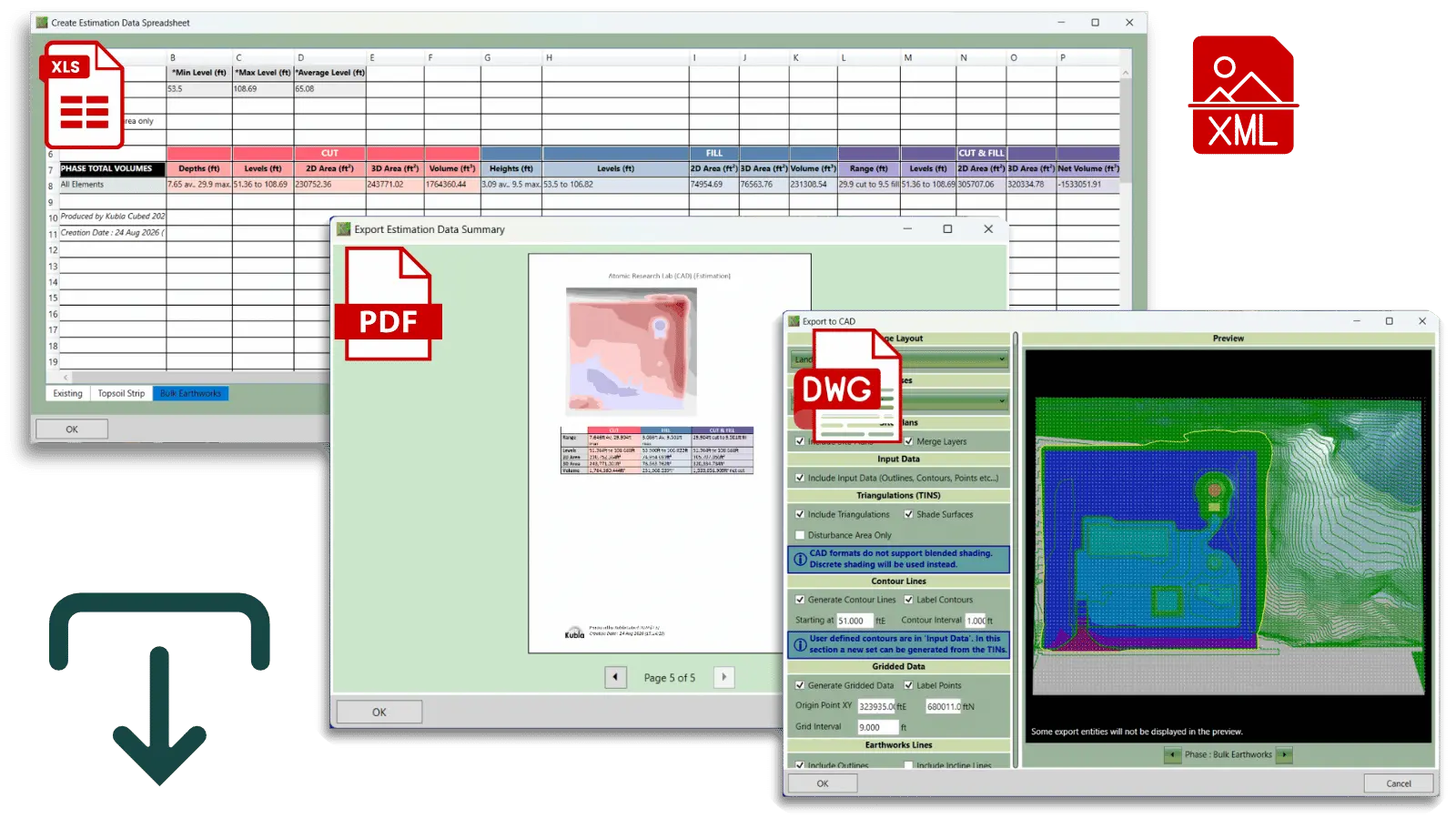
Create reports, spreadsheets, CAD files and LandXML data.
Faster
take off
Workflow efficiency
More accurate
cut & fill volumes
Improved accuracy
Reduced
rework
Save time
Improved estimator
confidence
3D visuals
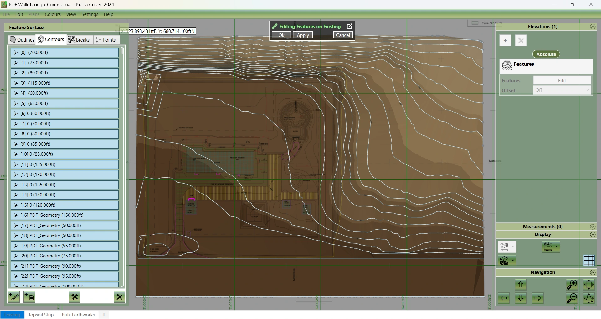
Extract or trace data to define surfaces
Turn your site plans into useable data.
PDF Vector Extraction
Extract points, contours, breaklines and outlines directly from vector PDF drawings.
CAD Import
Bring DWG and DXF linework into your project and use the data to build surfaces faster.
Manual Tracing
Quickly trace contours and site features when usable vector data isn't available.
Point Clouds & Survey Data
Import XYZ point data from drone surveys or LiDAR to build ground and proposed surfaces in Kubla Cubed.
Turn your site plans into a working site model
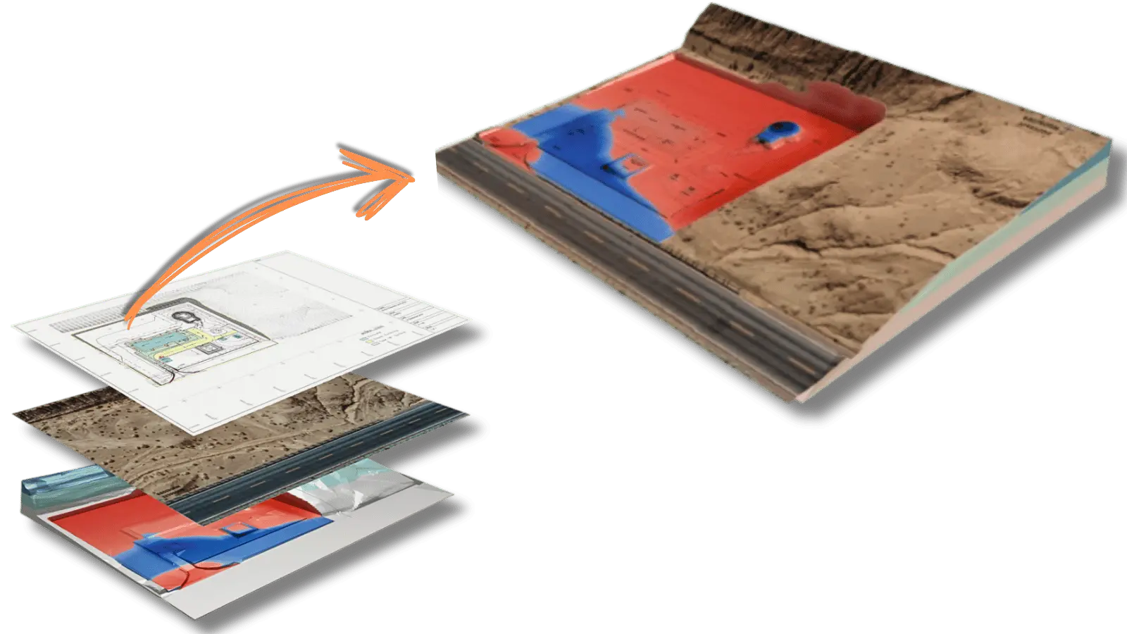
Combine multiple plans into one clear workspace
✓ Layer drawings above or below the proposed terrain model
✓ Switch plans on/off to compare existing vs proposed levels
✓ Align, crop and stitch multiple site page drawings
Create existing ground models
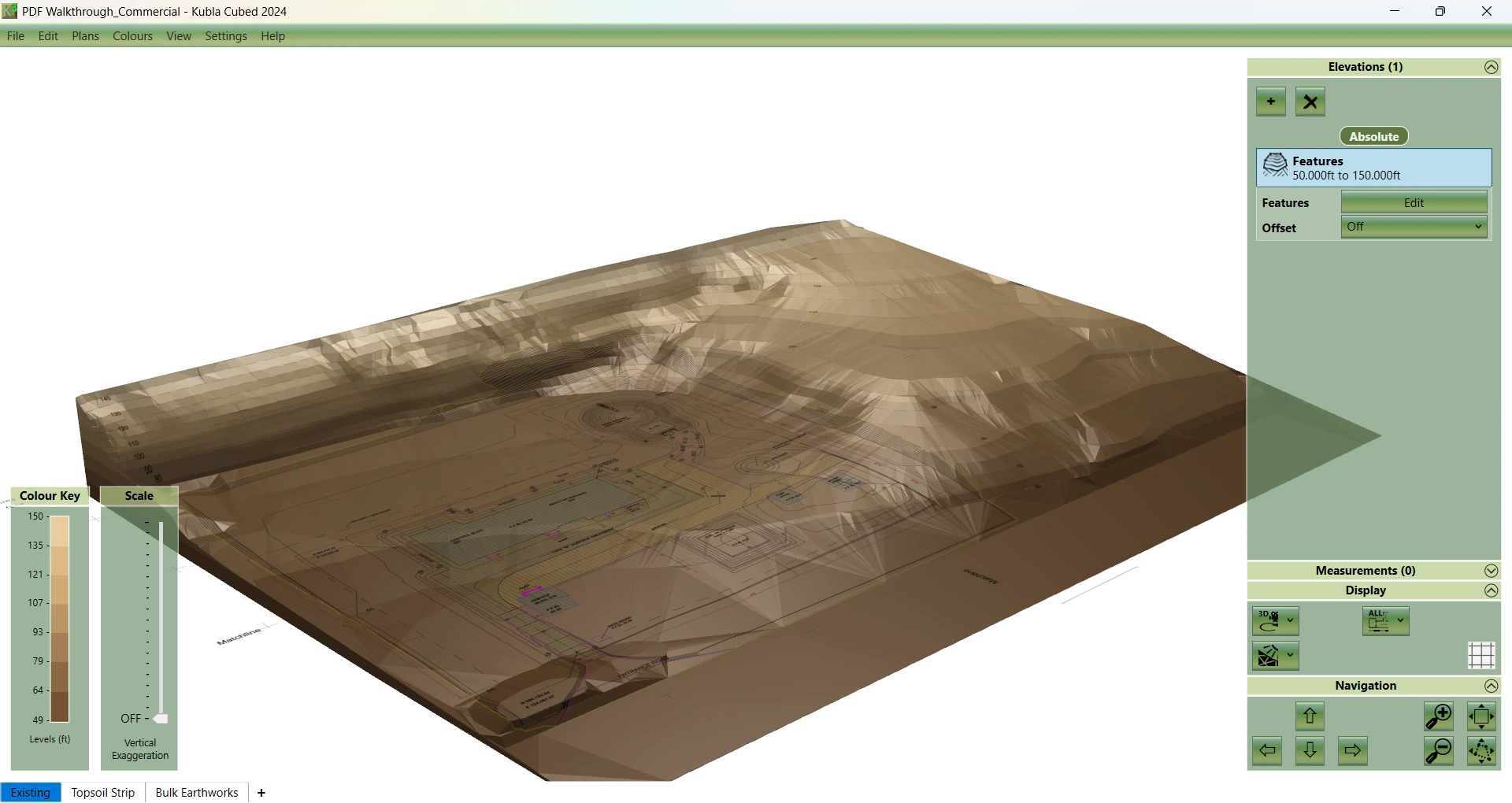
Turn survey data into a 3d terrain model
✓ Define existing ground levels using the data available from your project.
✓ Create existing surfaces using:
- Survey points.
- Contours.
- Breaklines.
- LandXML.
- TIN models.
✓ Visualise your terrain in 3D and identify potential issues before calculations begin
Understand your site before beginning your design.
Edit and prepare your data
Use Kubla Cubed’s line and elevation tools to clean up, organise and prepare imported or traced data.
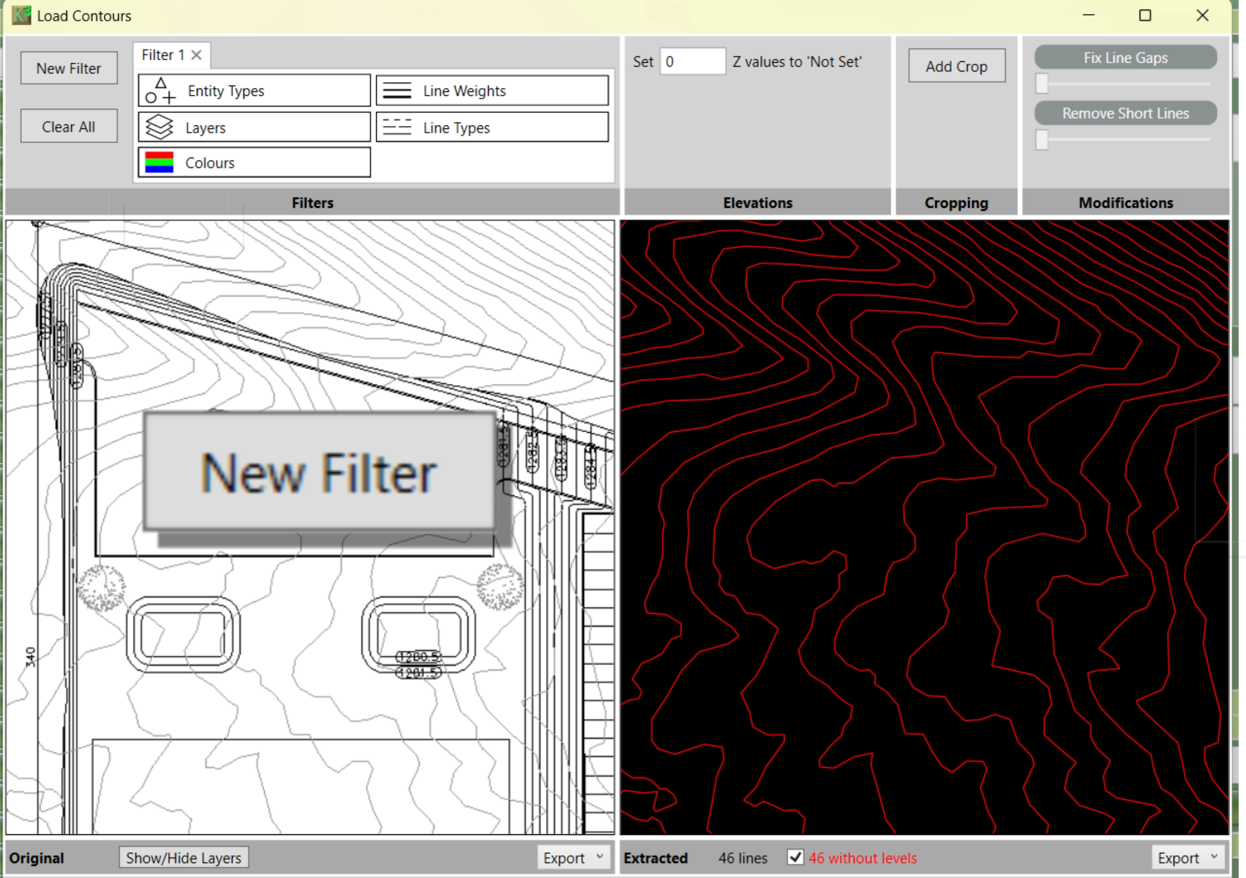
Filter data
Narrow down the data you want to work with.
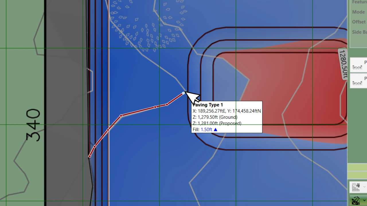
Trace features
Draw lines or outlines that can’t be extracted.
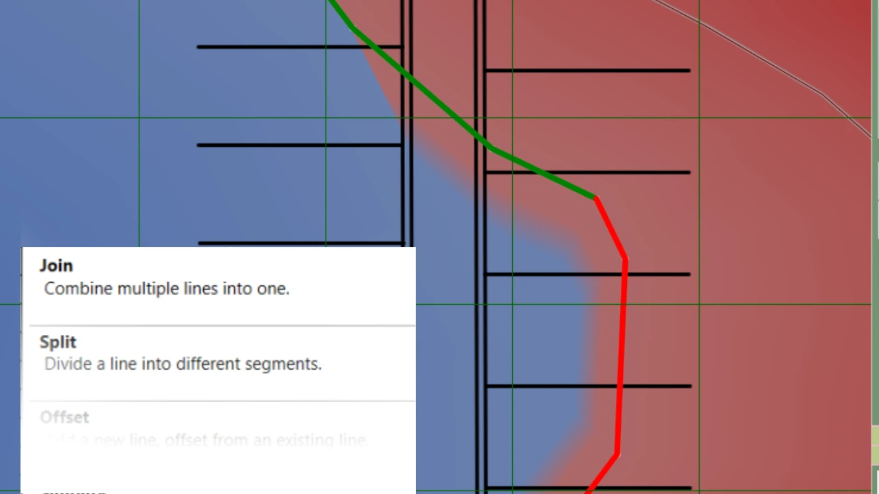
Join / split lines
Join separate lines or split them where needed.
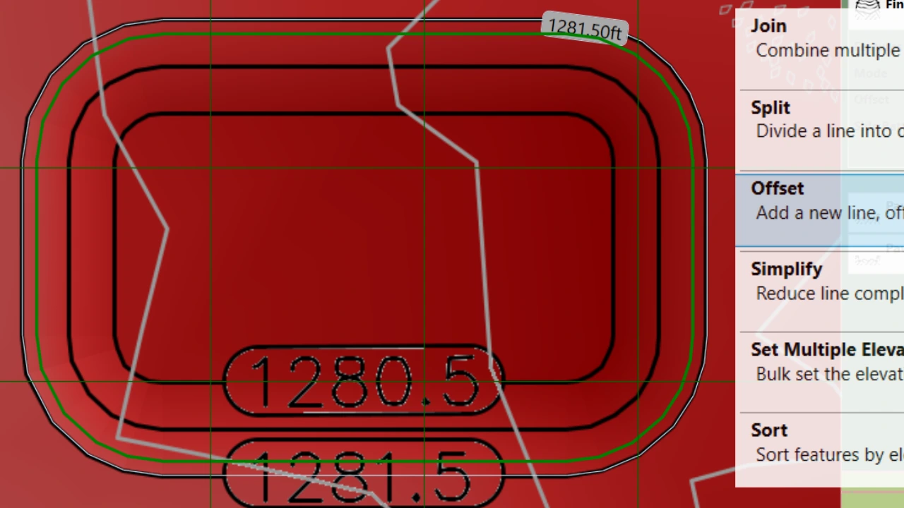
Offset lines
Create a new line at a set distance from another.
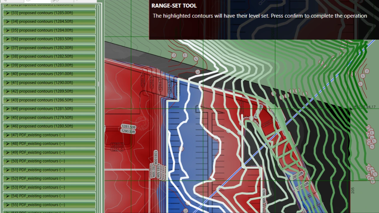
Set elevations
Apply elevations to one or more lines.
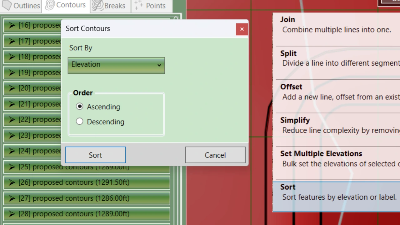
Sort lines
Put lines into the order you need.
Design proposed earthworks
Model everything from simple platforms to complex sites
✓ Create proposed level surfaces using flexible earthworks tools.
✓ Suitable for:
- Building platforms
- Roads and paths
- Slopes and embankments
- Trenches
- Stockpiles
- Landscaping
- Complex phased developments
✓ Kubla Cubed Professional users can create detailed proposed surfaces using advanced modelling tools.
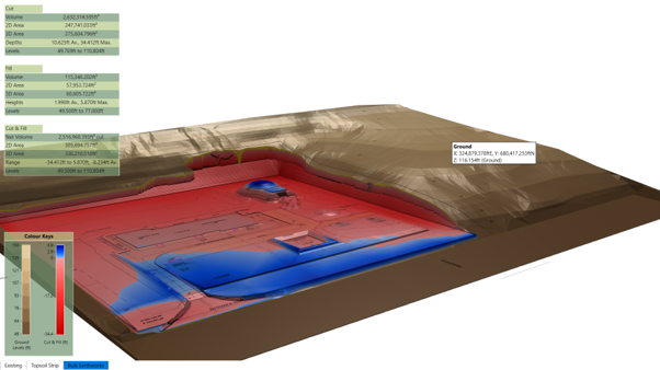
Plan earthworks in stages
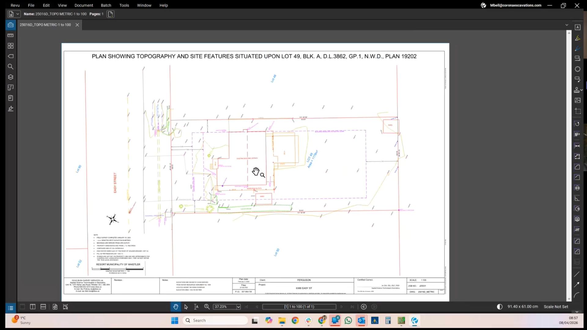
Site Survey
Survey displayed in CAD software
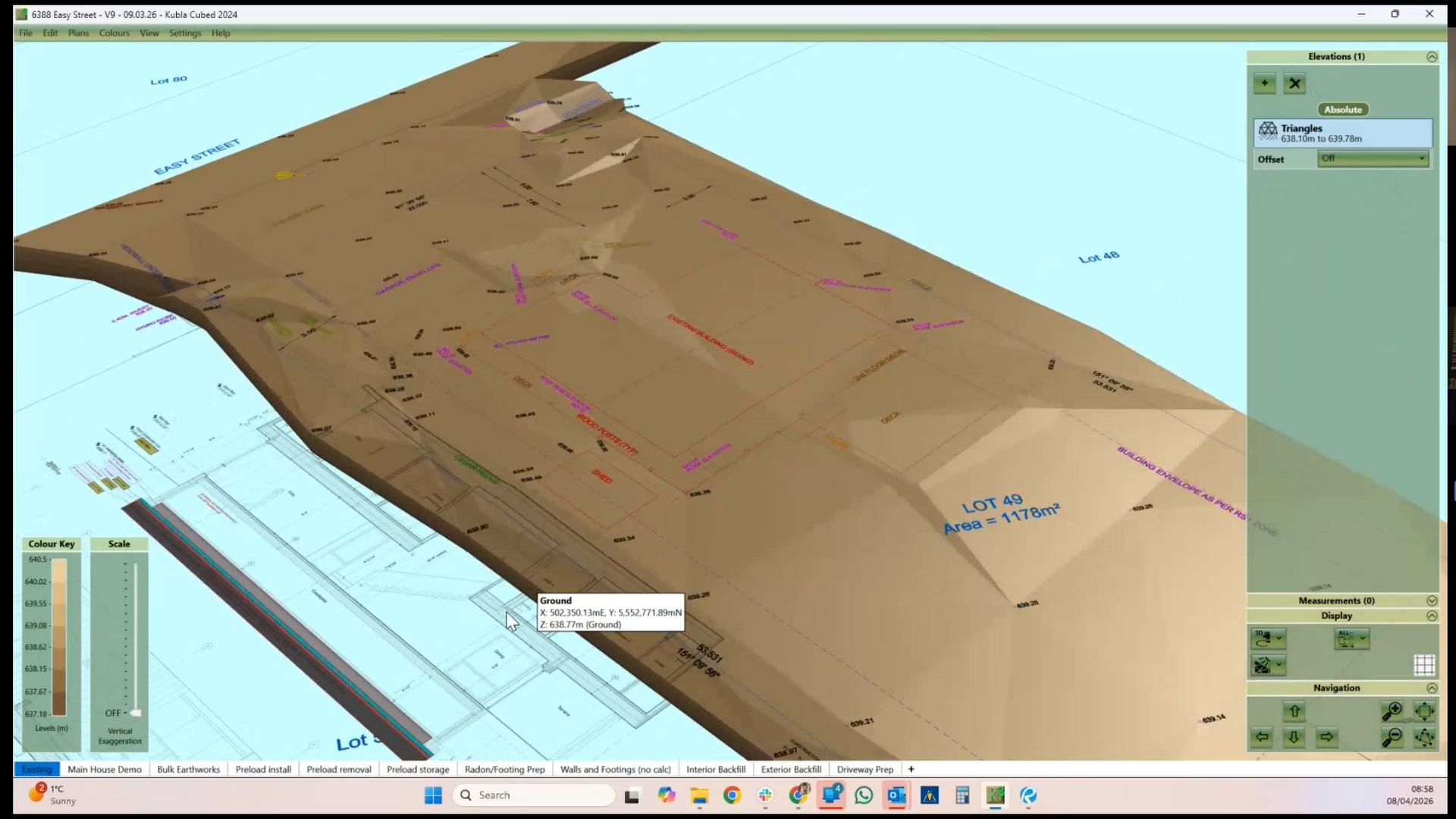
Existing Phase
Existing surface generated from TIN file with site survey plan overlayed
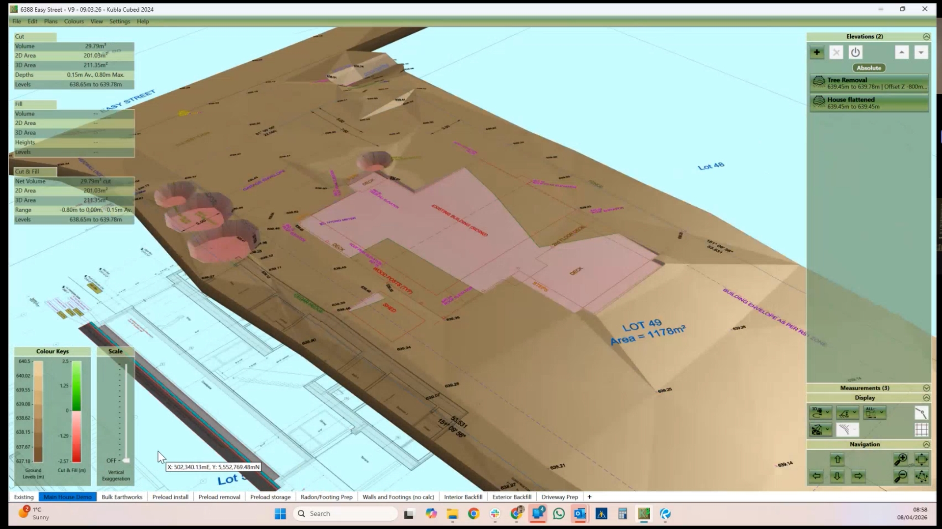
Demolition Phase
Existing building and trees removed.
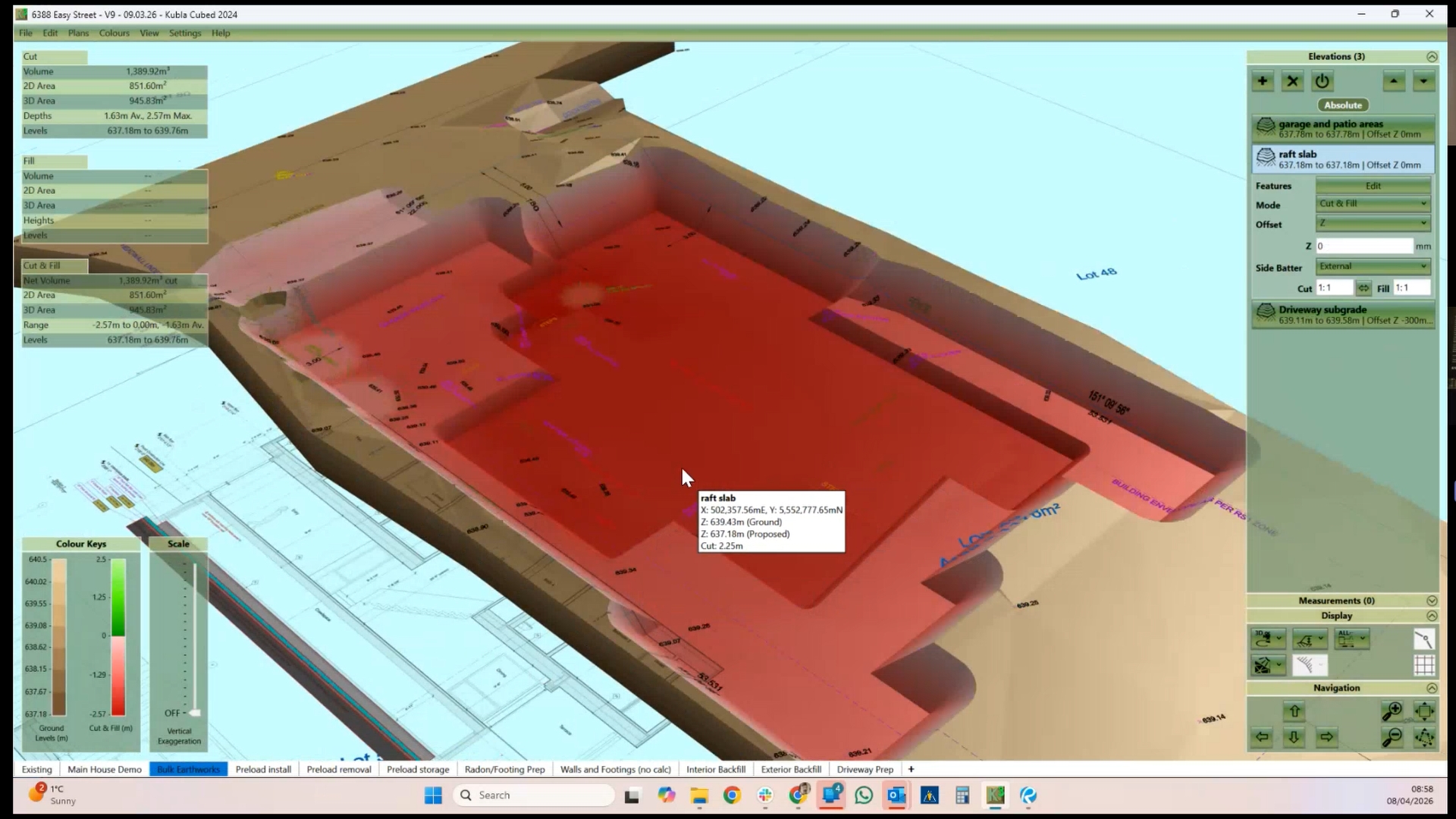
Bulk Earthworks Phase
Feature Surface elements used to complete bulk earthworks calculations
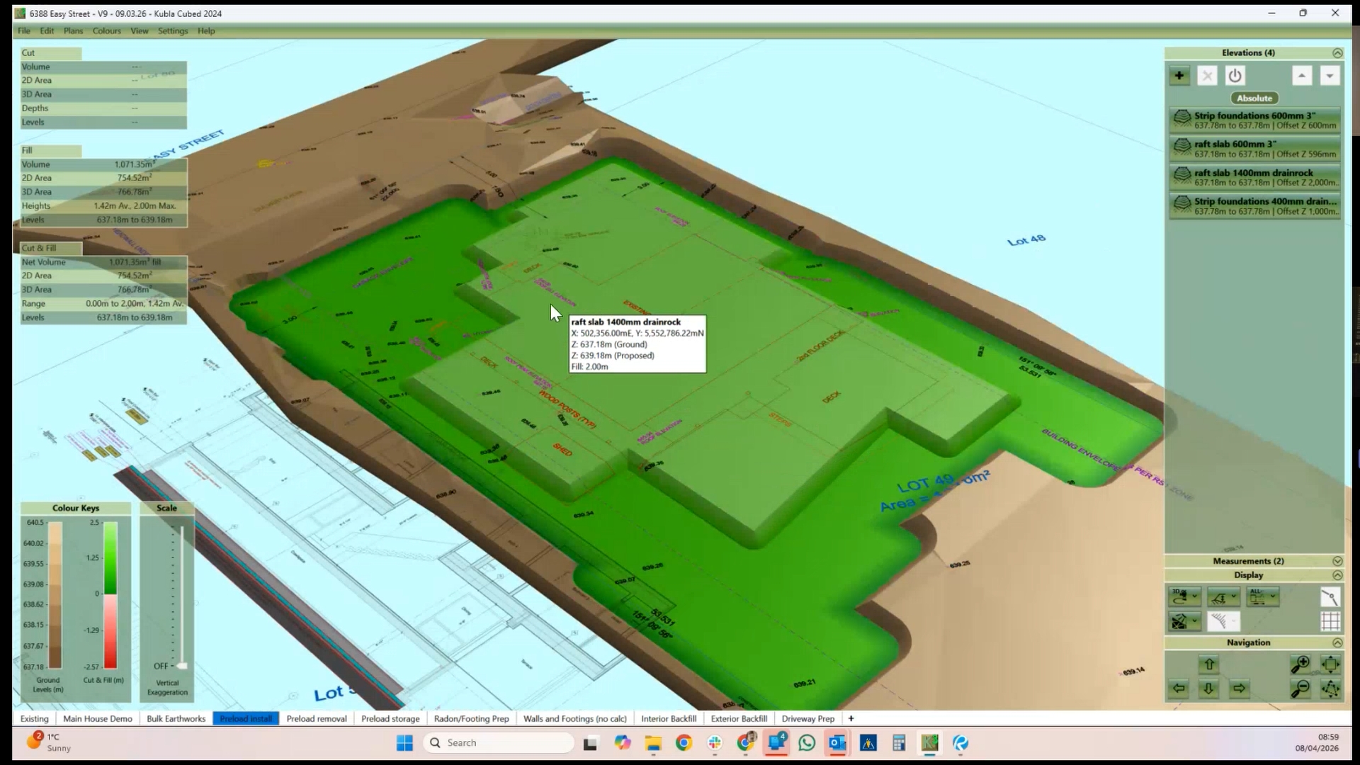
Preload Install Phase
Multiple Feature Surface elements to calculate the fill
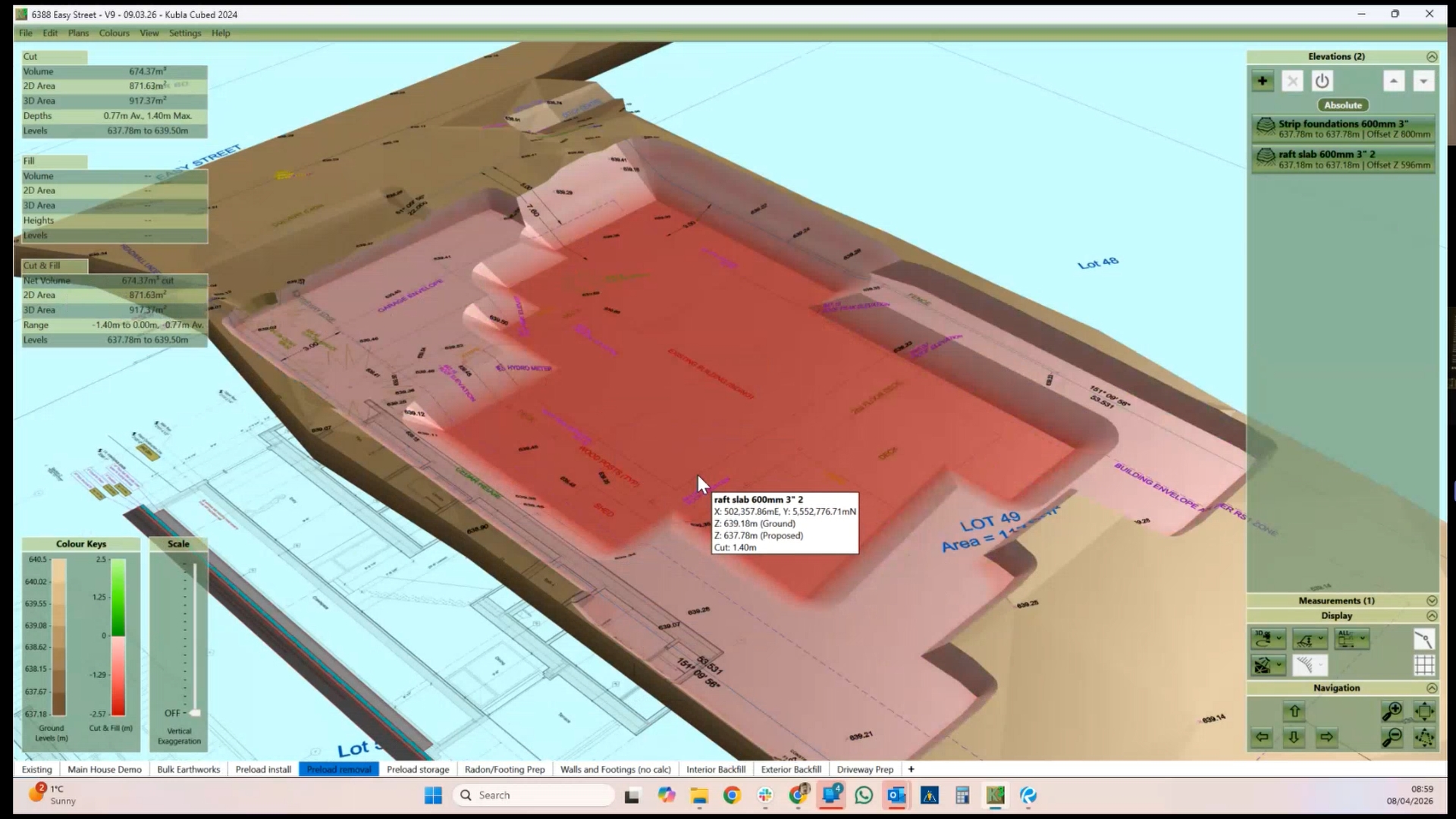
Preload Removal
Cut showing to remove preload
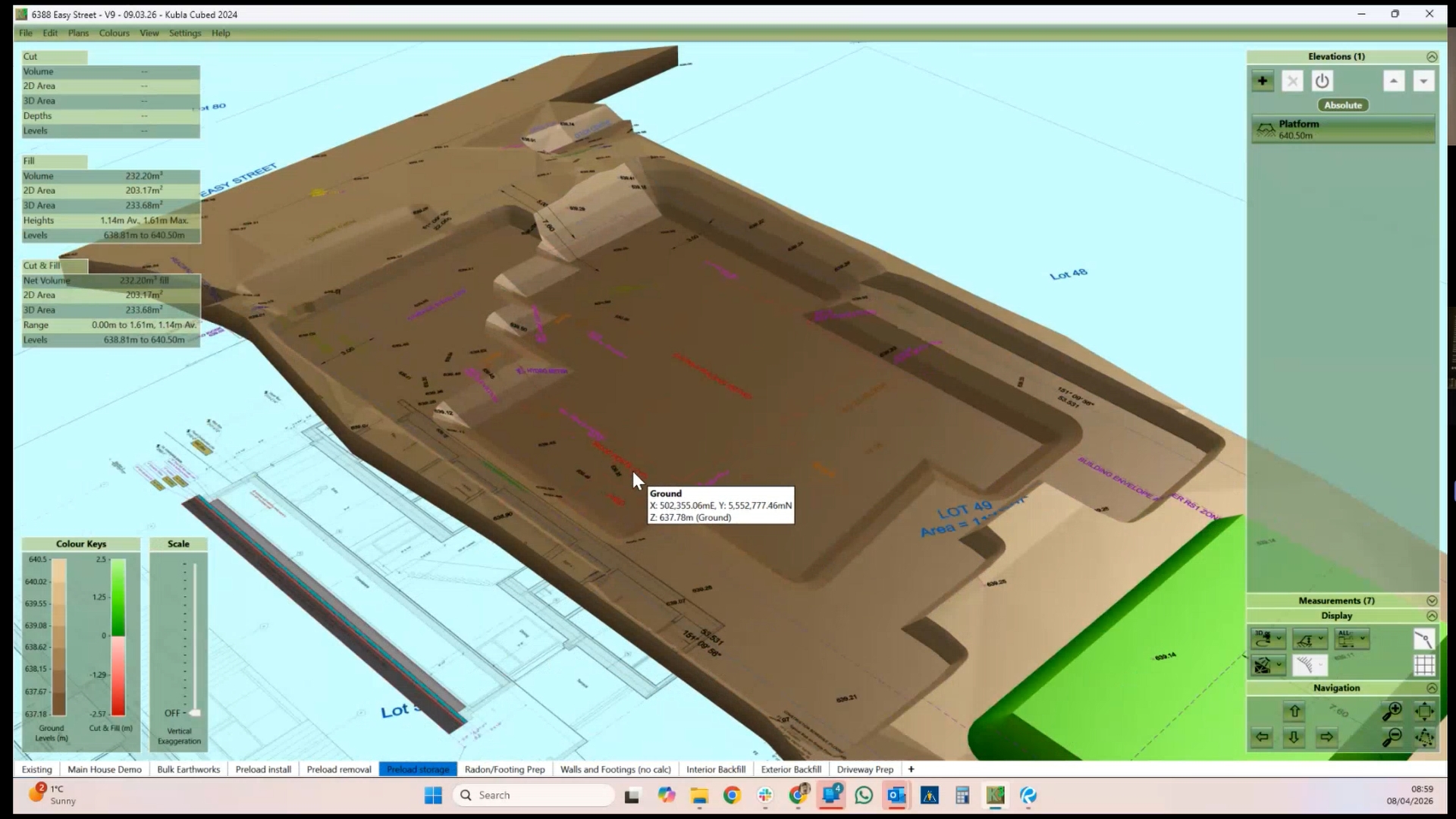
Preload Storage
Platform to define material storage
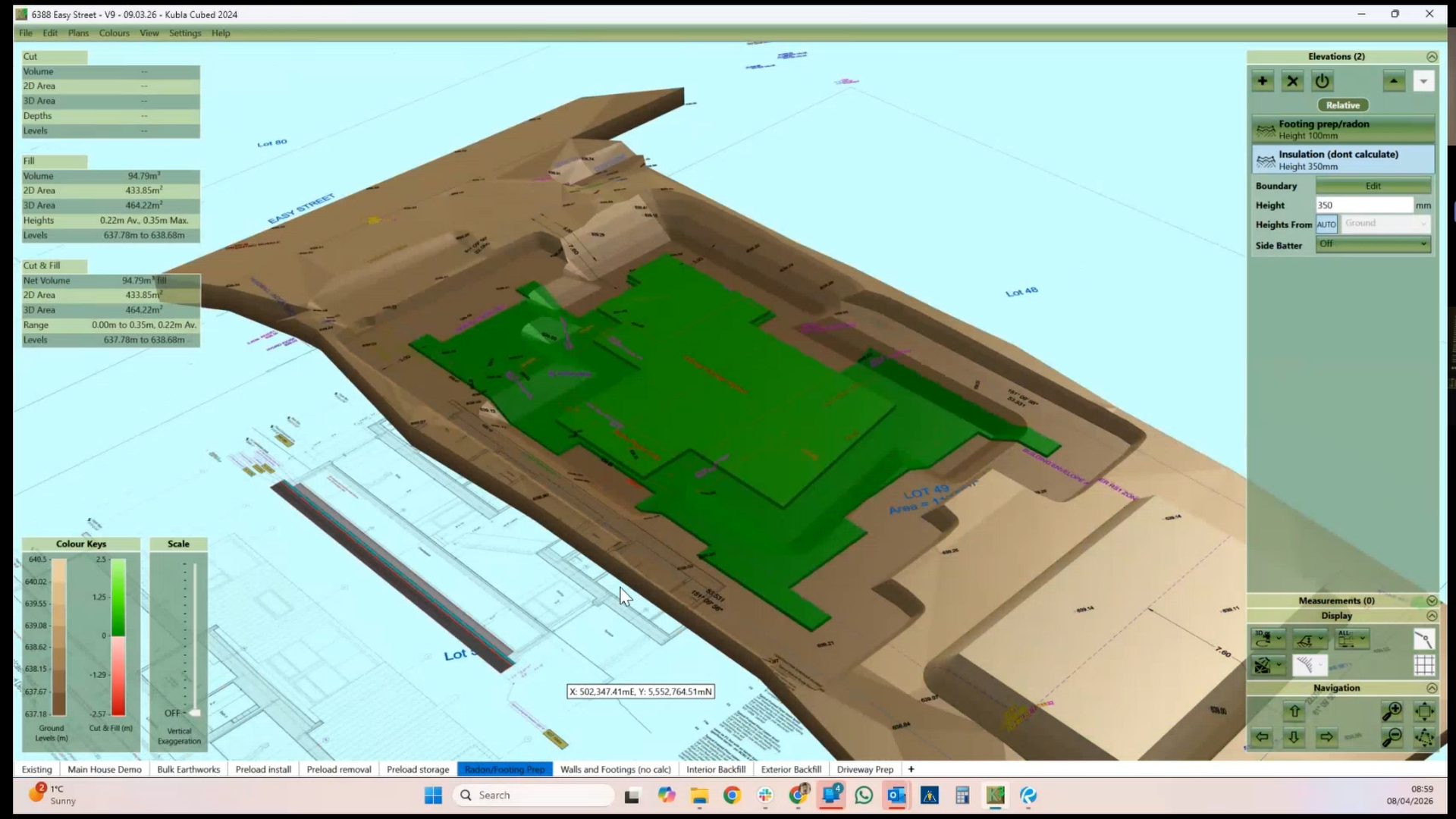
Radon/Footing Prep Phase
Two Raise elelments to define footing and insulation
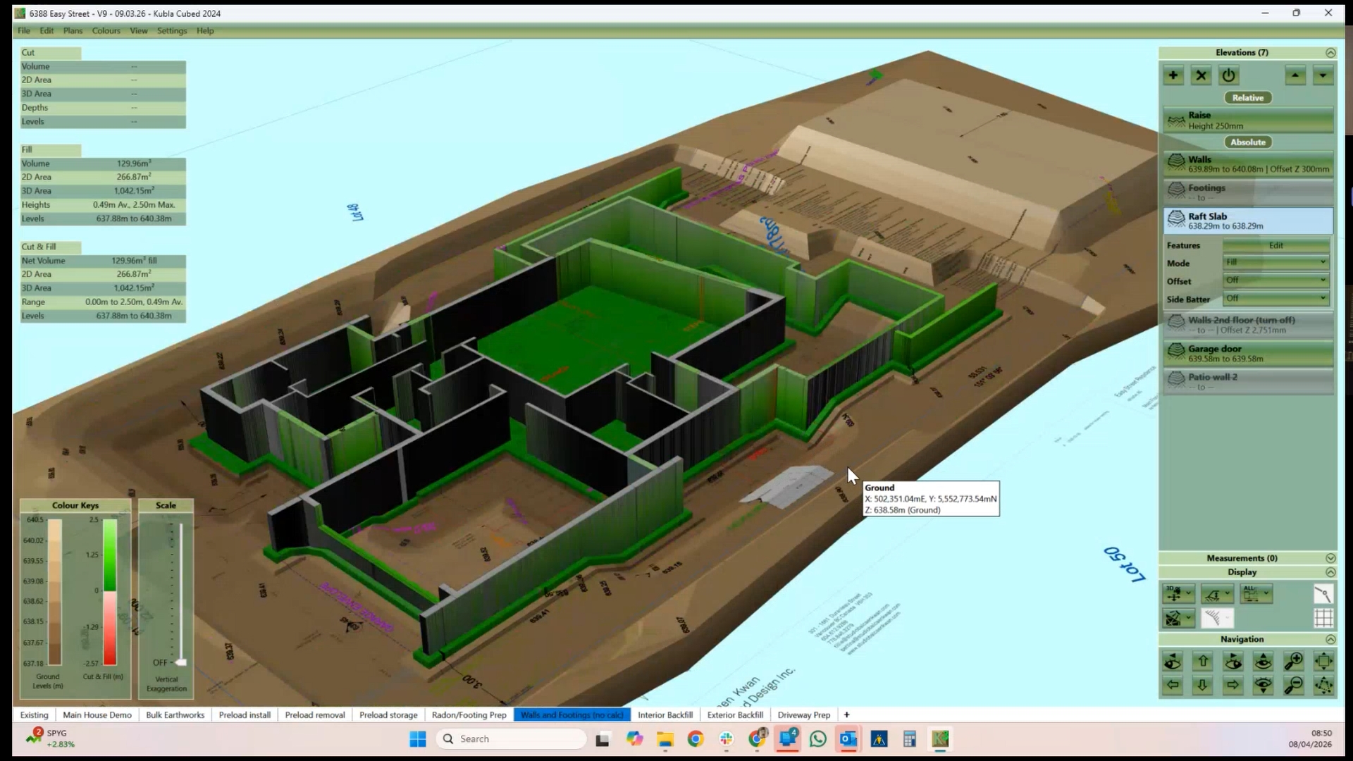
Walls and Footings (no calc) Phase
Defined surface with Raise and Feature Surface elements to generate a surface for subsequent phases.
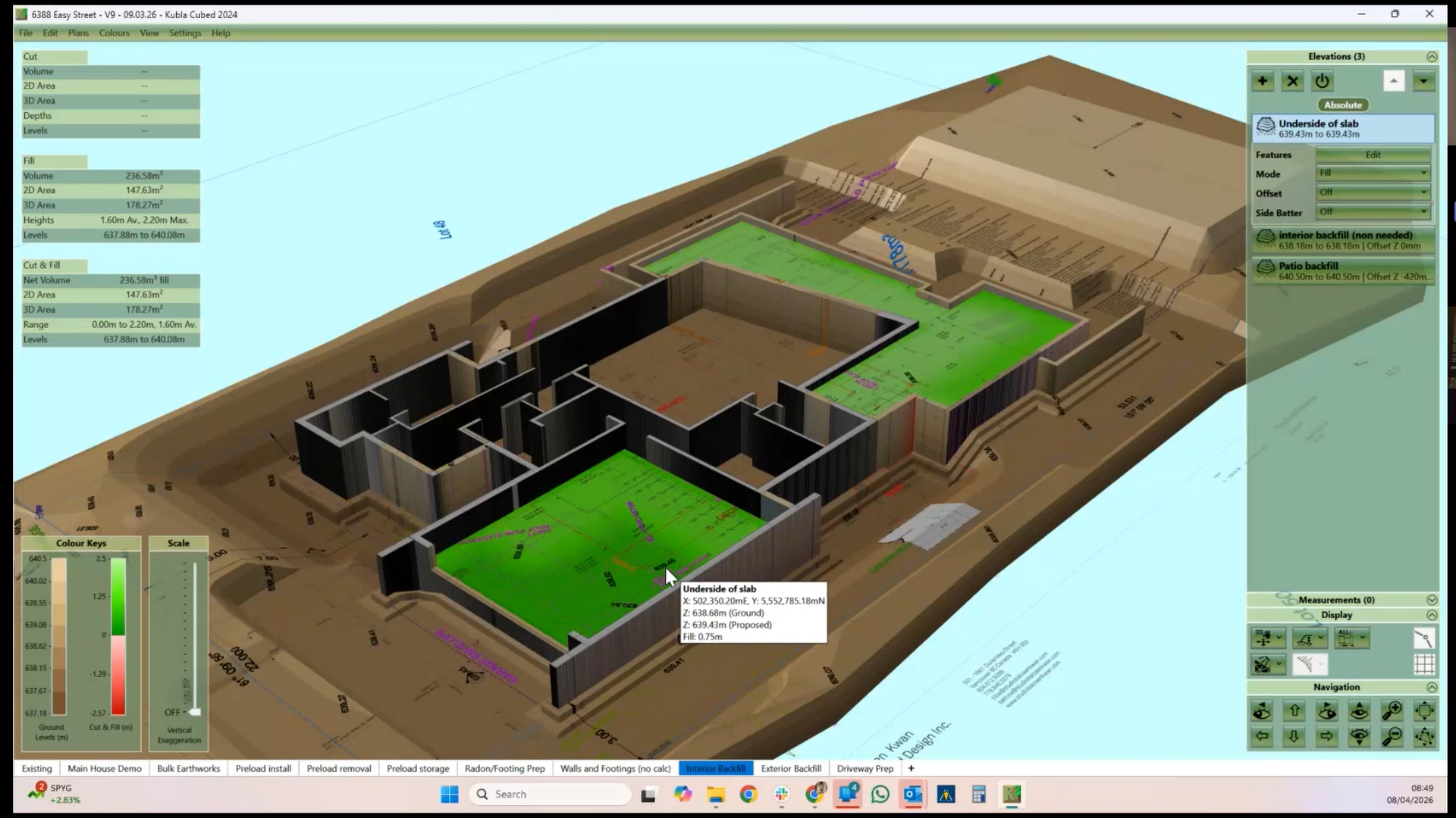
Interior Backfill
Feature Surfaces used to complete backfill.
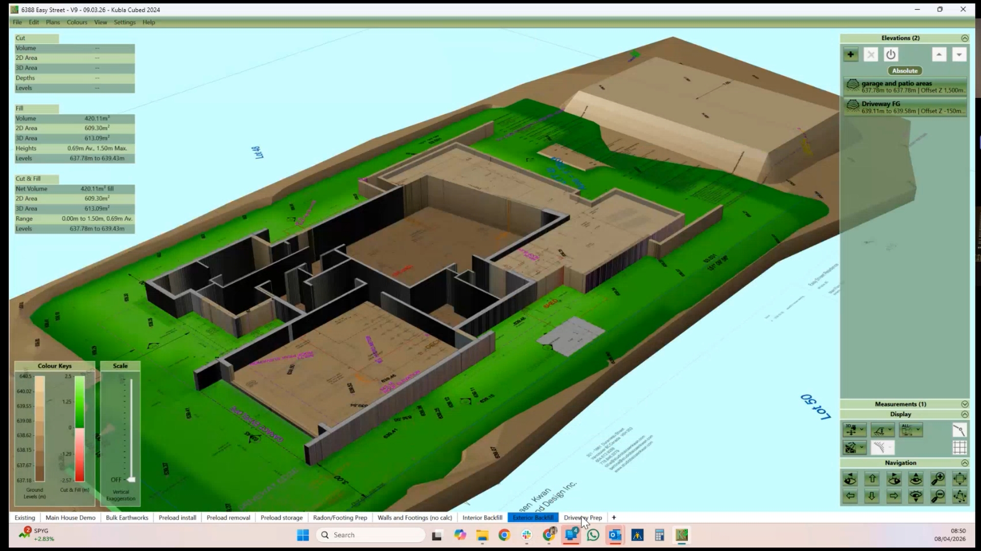
Exterior Backfill
Feature surfaces used to calculate exterior backfill
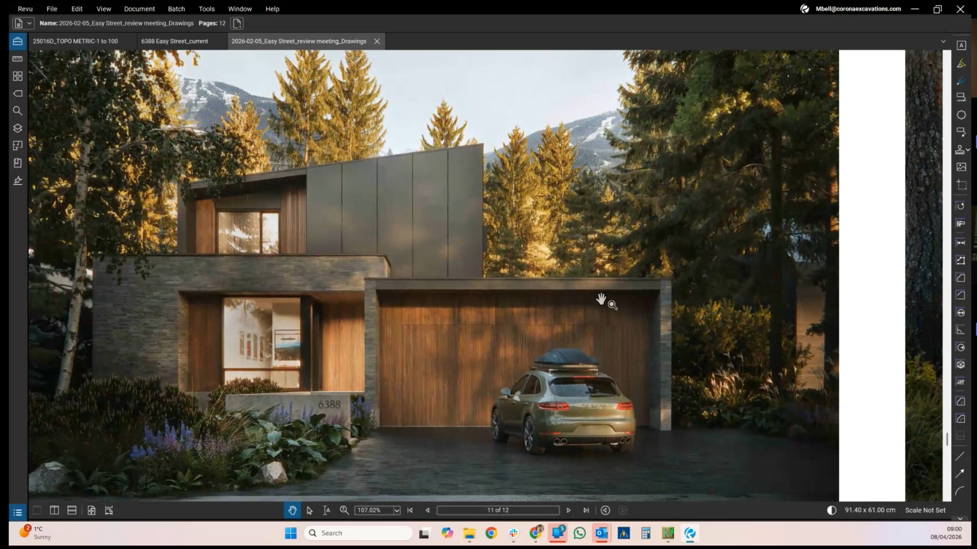
Rendering of Building
Rendering of final building used check 3D model is correct
Example of project phases taken from a user case study.

Check and validate your results
Use Kubla Cubed’s visualisation and analysis tools to check your terrain model, review calculations and make sure your results are right.
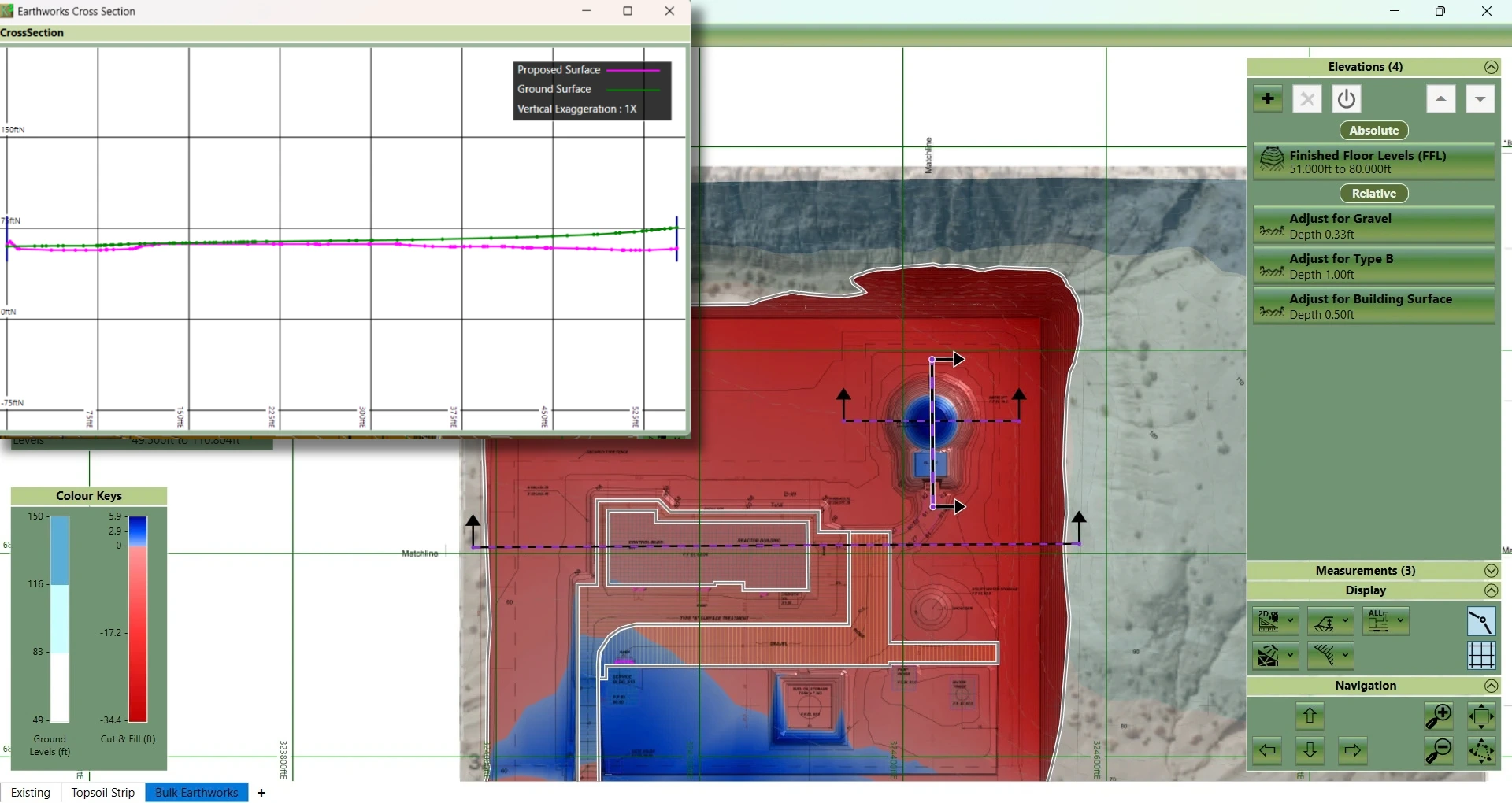
Cross sections
Inspect profiles through your terrain and check levels and slopes.
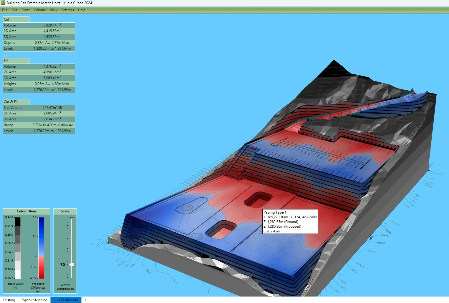
3D views
View your terrain model from different angles to spot unexpected features.
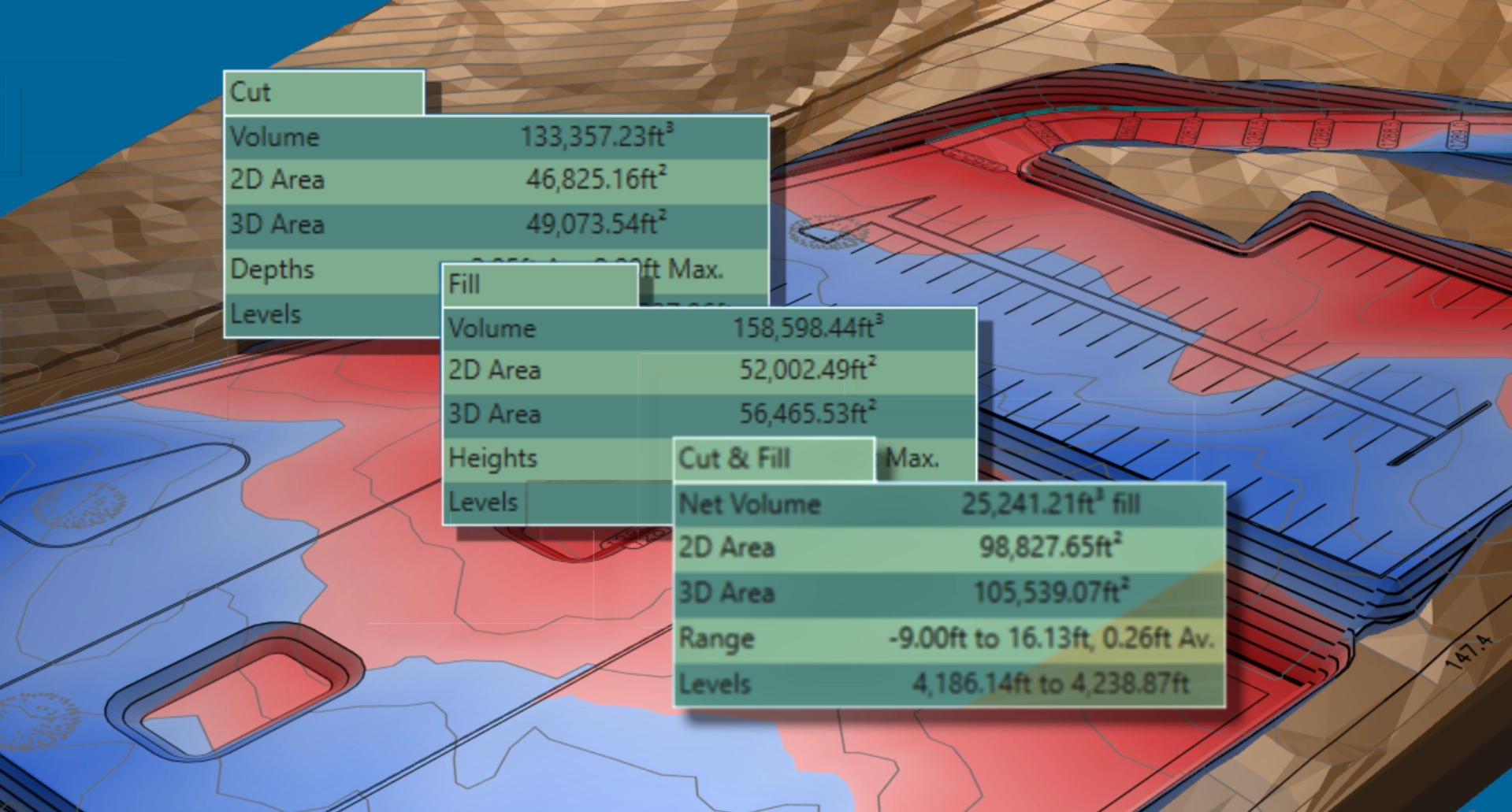
Results panel
Review volumes, areas and other key results in one clear panel.
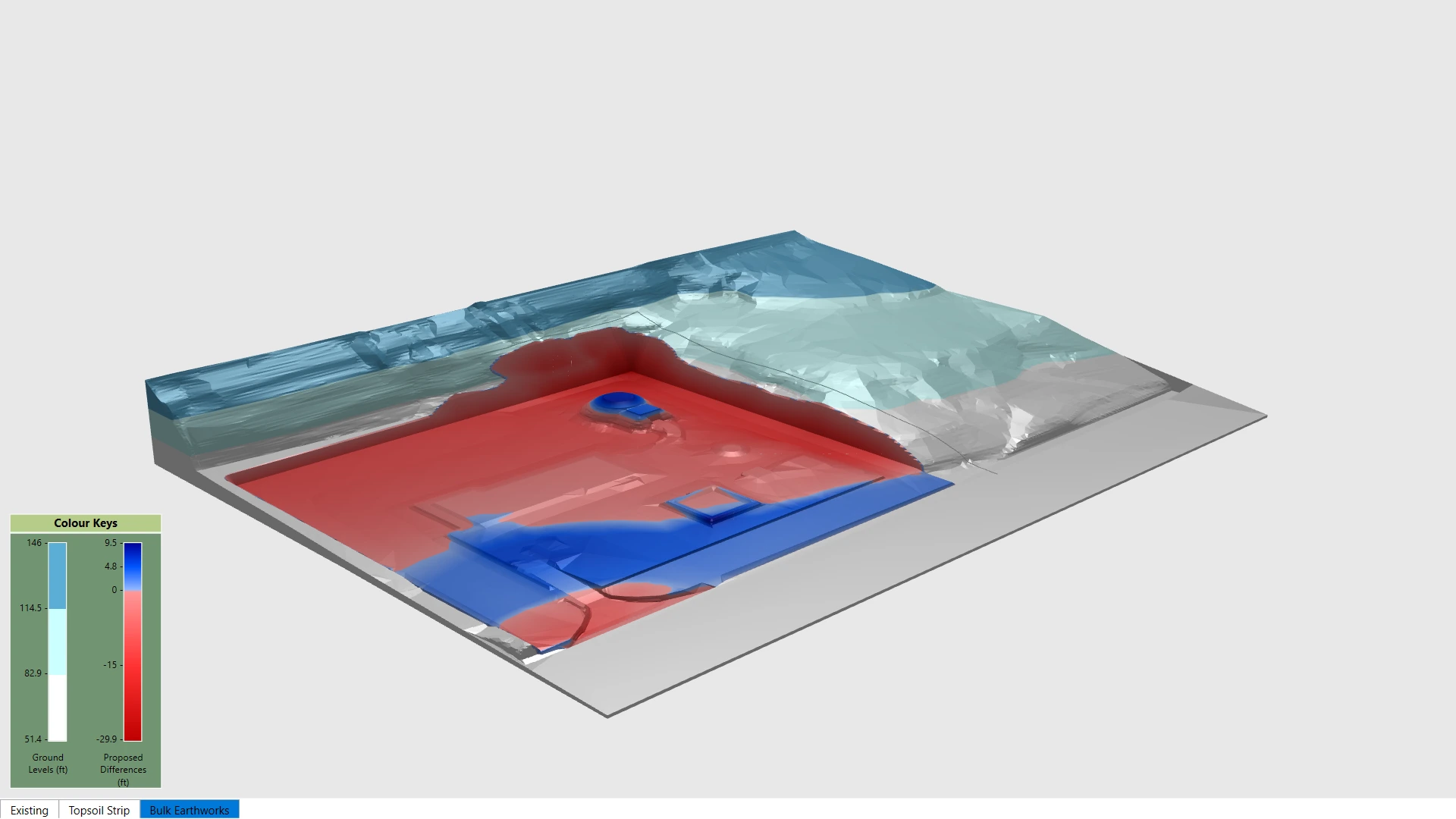
Shading modes
Use colour shading to quickly identify areas of cut, fill and balance.
Create professional reports
Export your calculations into formats your team and clients need.
Create:
✓ PDF reports
✓ Excel spreadsheets
✓ CAD drawings
✓ Land XML files
✓ Images
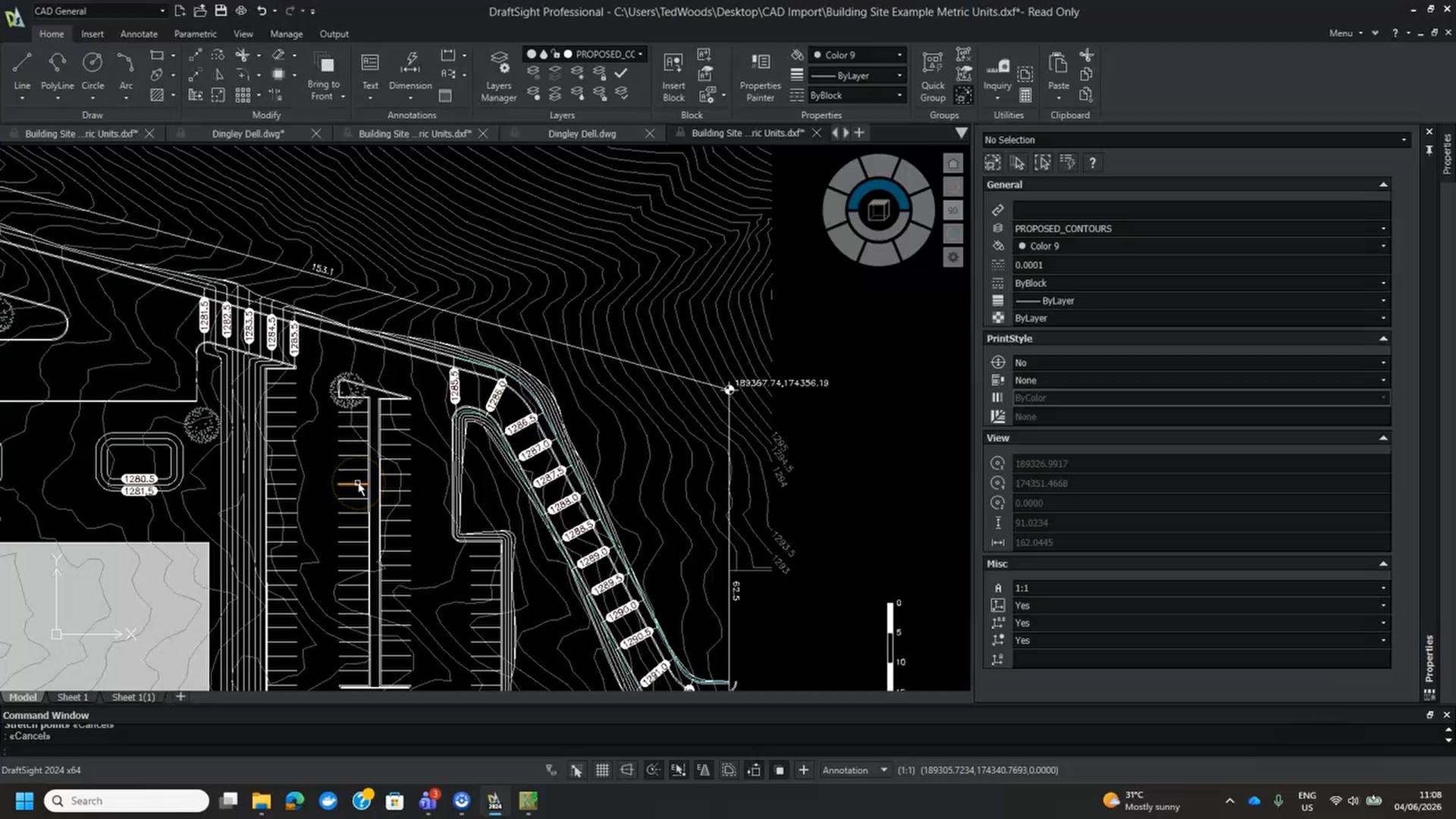
Streamline your existing workflow
Features Questions
▼ Can I model ponds and basins?
Yes. Kubla Cubed can model ponds and basins. You can create them using contour lines at different elevations, or use platform elements to build up the required shape. The software can then calculate the resulting cut and fill volumes.
For detention ponds and basins, you can define elevations from a fixed datum or depths from a base level, making it possible to model the proposed shape directly from a site plan.
Watch this video to find out more.
▼ Can I design retaining walls?
Yes. Retaining walls can be modelled using two breaklines within a feature surface, one for the top of the wall and one for the toe. You can also leave points on the breakline unset (–) so they are automatically interpolated from neighbouring points, making it easier to define complex wall shapes.
The offset tool can simplify the process further by creating one line from the other, helping you model retaining walls more quickly and accurately.
For a step-by-step guide, see our Retaining Walls in Kubla Cubed tutorial.
▼ How can I manage topsoil strip?
Kubla Cubed can calculate topsoil stripping separately by adding a reduce element, set to your requirements, in it’s own phase. This allows you to define a topsoil depth and report the stripped topsoil volume separately from the main cut and fill volumes.
Watch this video for more info.
▼ Can Kubla Cubed account for material swell and compaction?
Kubla Cubed calculates earthworks volumes based on the geometry of the surfaces. Material swell and compaction factors can be applied to the calculated volumes to account for changes in material volume during excavation, handling and placement.
This allows you to adjust your calculated cut and fill volumes to better reflect the expected site conditions and material behaviour.
▼ Can Kubla Cubed calculate excavation volumes for different strata?
Yes. Kubla Cubed can be used to calculate excavation volumes for different depth bands or strata, although this is currently a manual workflow rather than a built-in feature.
Each strata layer is modelled as a separate ground surface in its own project, using the same proposed surface. The excavation volume for each layer is recorded and the results can then be combined in a spreadsheet.
For accurate results, the strata surfaces must remain in a consistent vertical order and must never intersect with each other or the original ground surface.
We have a step-by-step tutorial demonstrating this workflow. Native support for multiple strata and depth bands is planned for a future version of Kubla Cubed Ultimate.
▼ Can I adjust to subgrade/formation level?
Yes. Kubla Cubed allows you to adjust your proposed surface to account for a required subgrade or formation level.
You can adjust the proposed surface using Reduce or Offset methods, depending on how your formation level is defined. This allows you to model the required excavation depth and calculate the resulting cut and fill volumes.
This can be particularly useful where the finished surface needs to be lowered to allow for materials such as foundations, paving, slabs or other construction build-ups.
Watch the Adjusting to Subgrade/Formation Level video to see how.
▼ Can I extract linework from PDF drawings?
Yes. Kubla Cubed includes PDF Vector Extraction tools that can extract vector linework directly from PDF drawings, helping you create surfaces and speed up take-off.
Depending on the quality and complexity of the PDF, this can be significantly faster than manually tracing contours. We’re also continuing to improve these tools, with further automation planned.
For a practical demonstration, see our Extracting PDF Vectors tutorial.
▼ Are there video tutorials?
Yes. We provide a range of video tutorials to help you learn Kubla Cubed and get the most from the software.
Our tutorials cover common workflows including importing data, creating surfaces, calculating cut and fill volumes, designing earthworks, and exporting results. They are designed to help both new and experienced users understand the software features and apply them to real-world projects.
New videos and guides are added regularly to cover new features, workflows, and tips from our team.
▼ What's the difference between Lite and Professional?
Kubla Cubed Lite is a free, no time limit edition that includes the essential tools for creating terrain models, designing simple platforms, and calculating accurate cut and fill volumes from PDF and CAD drawings. Kubla Cubed Professional includes everything in Lite, plus advanced design tools, cross sections, detailed reporting, additional import and export options, and features for more complex earthworks projects. Find more details on the Compare page.
Both editions use the same calculation engine and interface, making it easy to start with Lite and upgrade to Professional whenever your project requirements grow.