Once the Channels module is enabled, you will see an extra ribbon button as shown below. For a description of how to enable the Channels module see Activating Licenses.
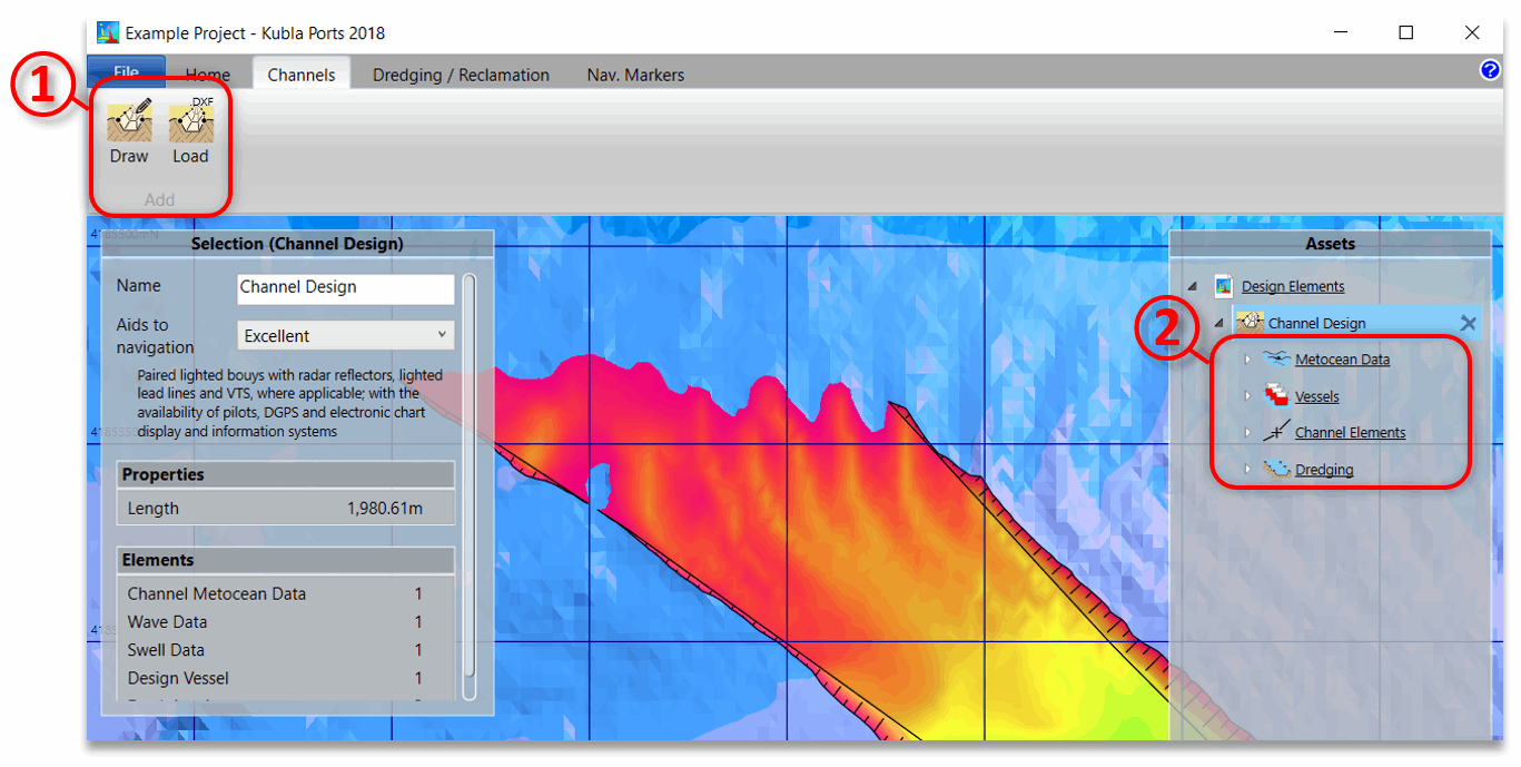
A new channel can be created by clicking one of the buttons on the ribbon ①, choosing to either define the centre-line on the screen or load it from a CAD .dxf file.
Once the centre-line has been defined a channel item will be created and will appear in the side bar ②. This item will have four automatically-generated child items:
- Metocean Data. This holds the metocean data that will be used to design the channel. For more details see Metocean Data.
- Vessels. This defines the vessels used to design the channel. For more details see Design Vessels.
- Channel Elements. This defines both the basic geometry, as well as properties for each section (straight or bend) of the channel. For more details see Channel Elements.
- Dredging. This is a group of dredging areas which are automatically-generated based on the channel dimensions. Although the outlines of these dredging areas are locked, you can still amend the side slopes as described in Dredging & Reclamation.
As well as these child items, the channel itself has the following properties:
- Aids to Navigation. The quality of aids to navigation for the channel. This affects the calculated widths as described in the Technical Manual.
The channel item can generate the following exports:
- Design Summary (.docx, .pdf). Exports a comprehensive summary of the calculations that have been performed to determine the channel dimensions.
- Cross Sections (.dwg, .dxf). Exports cross sections at regular defined intervals along the channel, showing the existing and dredged bathymetry levels.