Kubla Cubed 2019 Video Tutorials
The following video tutorials give an overview of the features in Kubla Cubed 2019. It is a recommended resource for new users of the software. We also have some video collections providing start to finish walk-throughs using projects that are shipped with the latest version of our software. Additional videos including support for older version of the software can be found on our YouTube channel.
Kubla Cubed works in metric and in imperial (English) units. Some of the videos are in metric and some in imperial, but the principles covered are the same regardless of the units used.
GETTING STARTED
The sections below take you through the steps you are likely to take to set up your project. However, there are some things that it is useful to know before you start. In these videos we explain where you can find example projects, how to navigate around a project, and options for units and display settings.
Example Projects
Navigation
Units & Display Settings
SITE PLANS
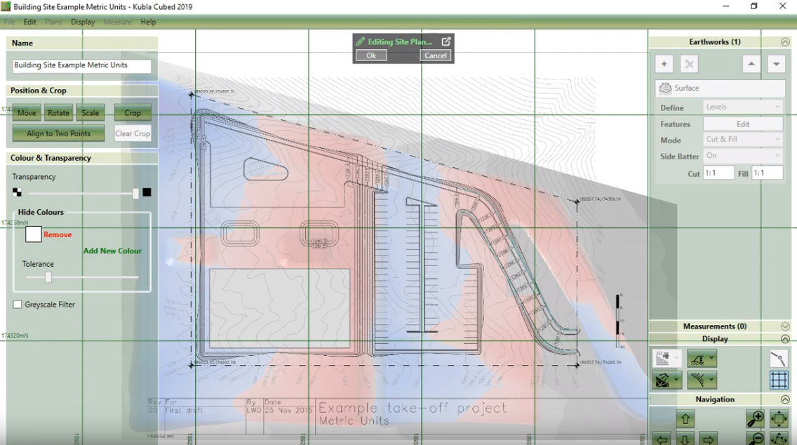
Site plans are PDF’s or image files that you load in to display in your project. If you are doing any on-screen take-off this is the essential first step. Even if you are loading all of your data from CAD files, it can still be useful to load site plans to give context to your visualisations. These videos describe the tools available to define site plans in Kubla Cubed.
Overview
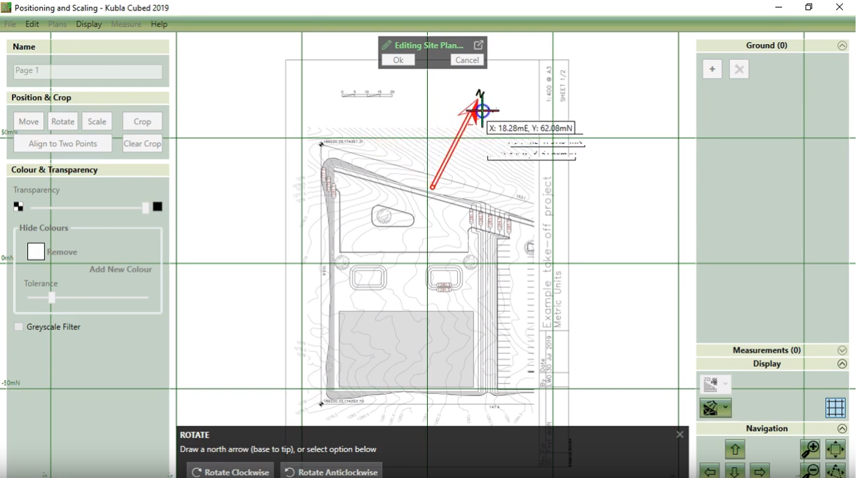
Scale, Position / Align
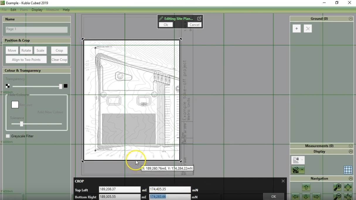
Cropping
Transparency
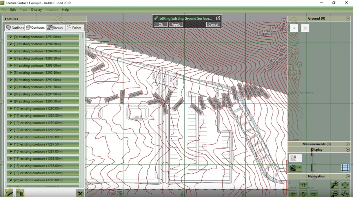
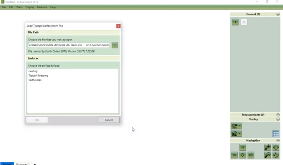
EXISTING GROUND LEVELS
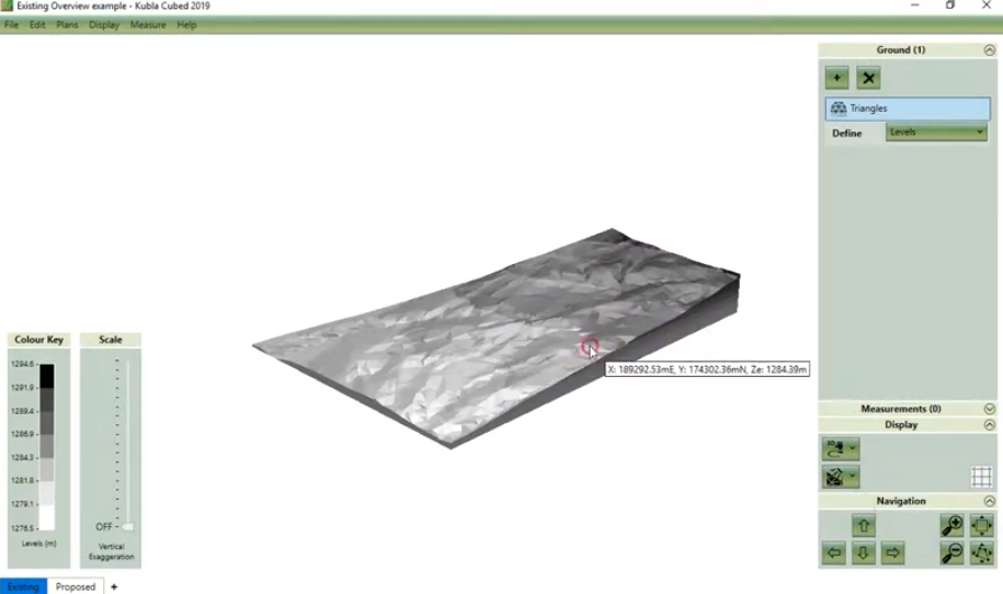
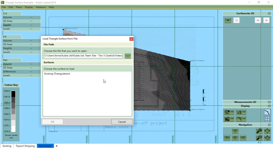
After loading any site plans, the next stage is to define the existing ground levels. This is usually achieved using a feature surface, but if you have a file which contains defined surfaces you can load a triangle surface instead. These videos describe the options in Kubla Cubed to define the existing ground levels.
Overview
Feature Surface
Triangle Surface
SITE STRIPPING
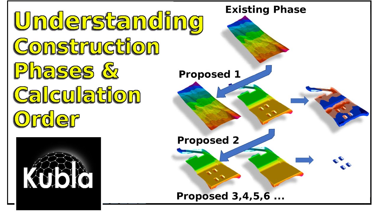
On most projects there is a requirement to remove topsoil and/or other material from the site, before building the site back up to the formation levels. In this video we describe the tools available in Kubla Cubed to define topsoil stripping and/or other demolition areas. It is helpful before you start with topsoil stripping if you understand how construction phases work in Kubla Cubed, since a construction phase will be used to define site stripping.
Overview
Construction Phases
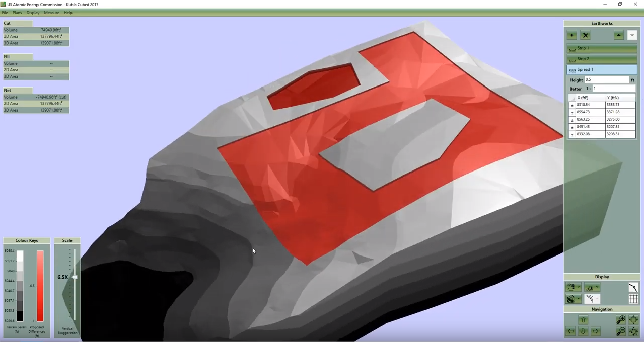
PROPOSED EARTHWORKS (Building Pads, Cark Parks, Sports Pitches, Ponds)
Kubla Cubed has a range of earthworks feature types, that allow great flexibility when defining your proposed ground levels. You can either use one or multiple earthworks elements together to define your design levels. The most common situation is to use a single feature surface, since this is the most versatile earthworks element. However, in some situations the other earthworks elements can also be extremely useful.
Overview
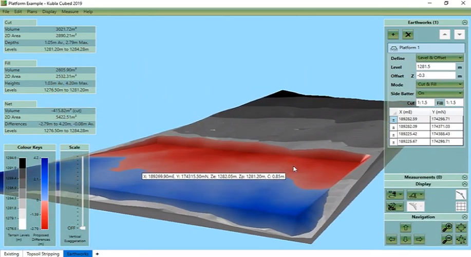
Platform Element
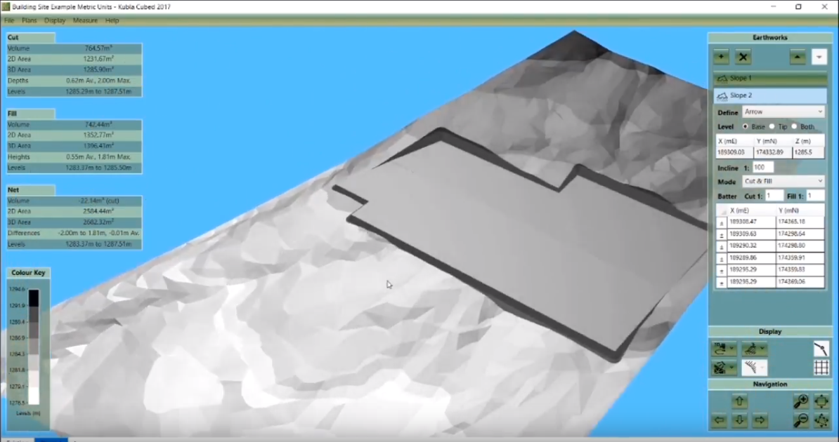
Slope Element
Triangle Surface
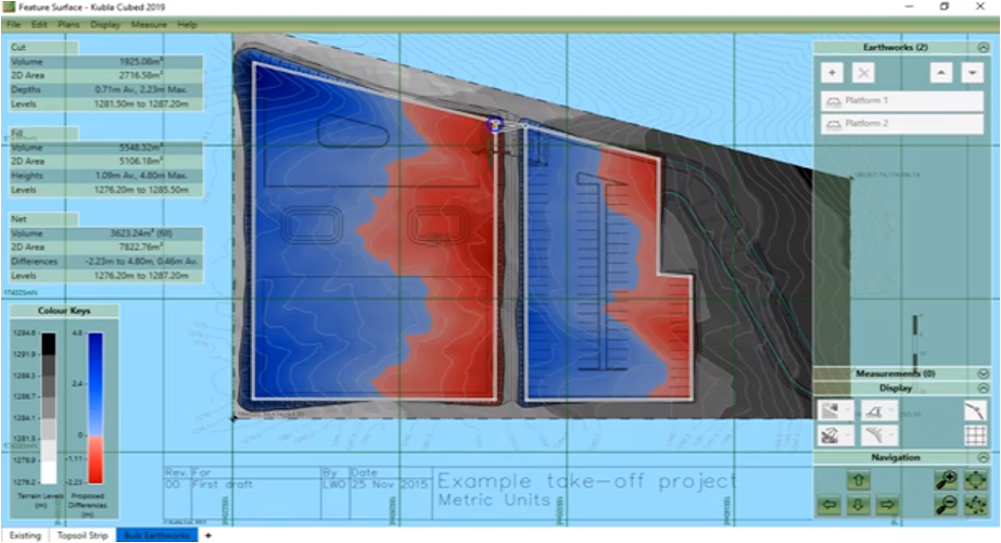
Feature Surface: (Contours, Points & Breaks-Lines)
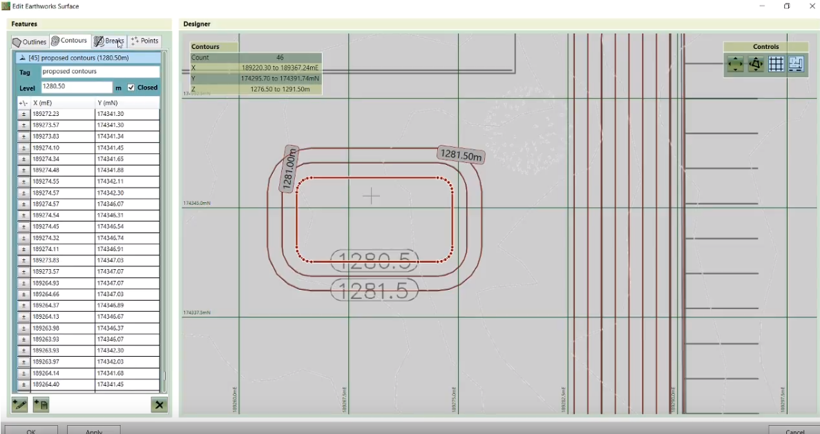
Understanding Feature Surface
Outlines

PROPOSED EARTHWORKS (Roads and Paths)
Accurately defining the roads and paths on a proposed site plan is key to producing precise cut and fill values. The Path element is useful for simple pathways with a standard width. However, more complex scenarios require the use of the more powerful Feature Surface.
Path Element
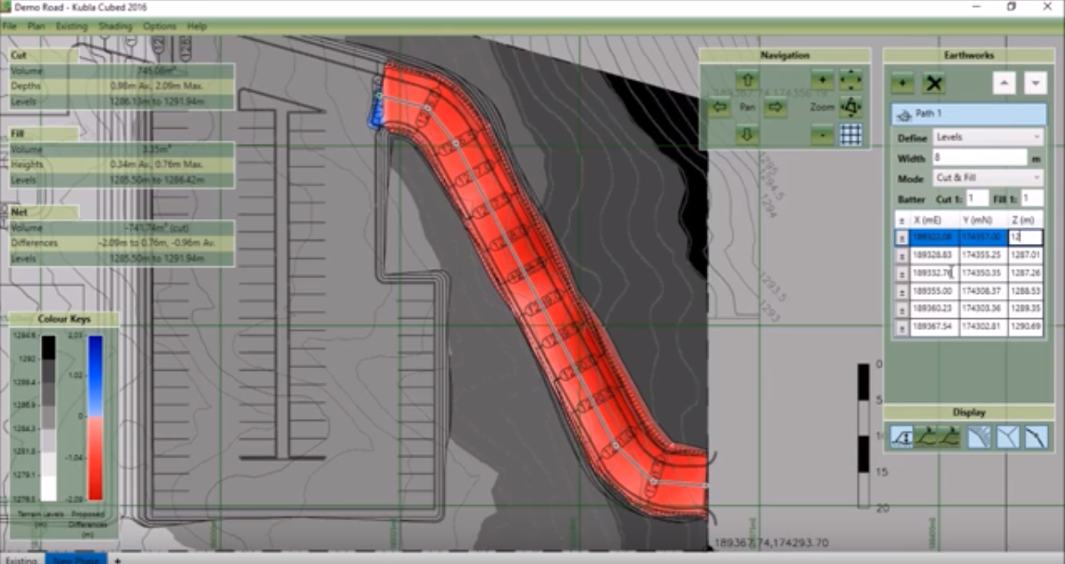
Roads & Paths

ADJUSTING FINISHED LEVEL (FFL) TO FORMATION/SUBGRADE LEVEL
Most drawings will define finished levels, whereas the earthworks volumes are only up to the formation level. The defined levels therefore need to be reduced to account for different surfacing materials. In this video we cover the different methods to achieve this in Kubla Cubed.
Adjusting FFL to Formation/Subgrade Level
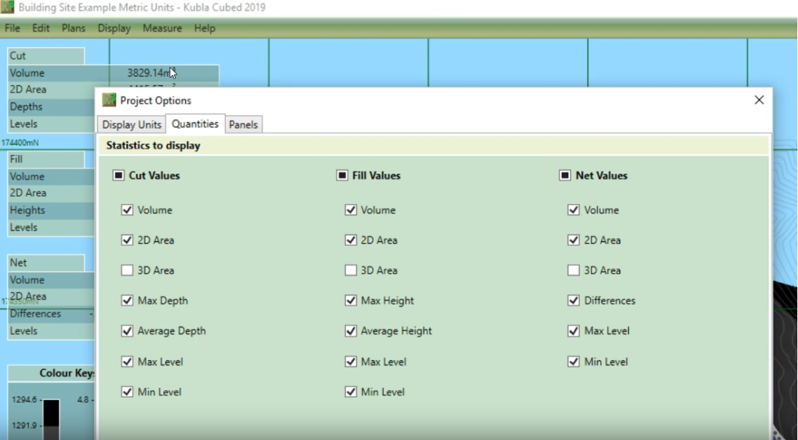
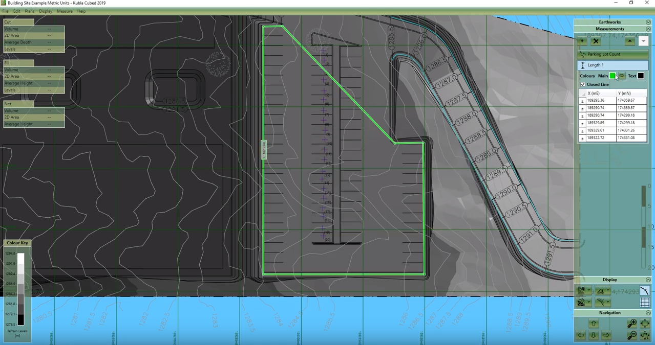
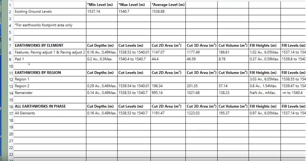
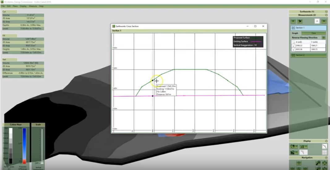
MEASUREMENTS
Measurements can be used to measure non-earthworks content in your project, such as the length of a fence line, or an area of the site. They can also be used to query the earthworks quantities in more detail. For example, the volume region can be used to query the earthworks in a specific area of the site. In these videos we overview the options that are available in the measurements panel of Kubla Cubed.
Counts, Lengths & Areas
Volume Regions
Cross Sections
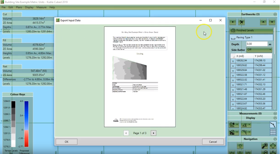
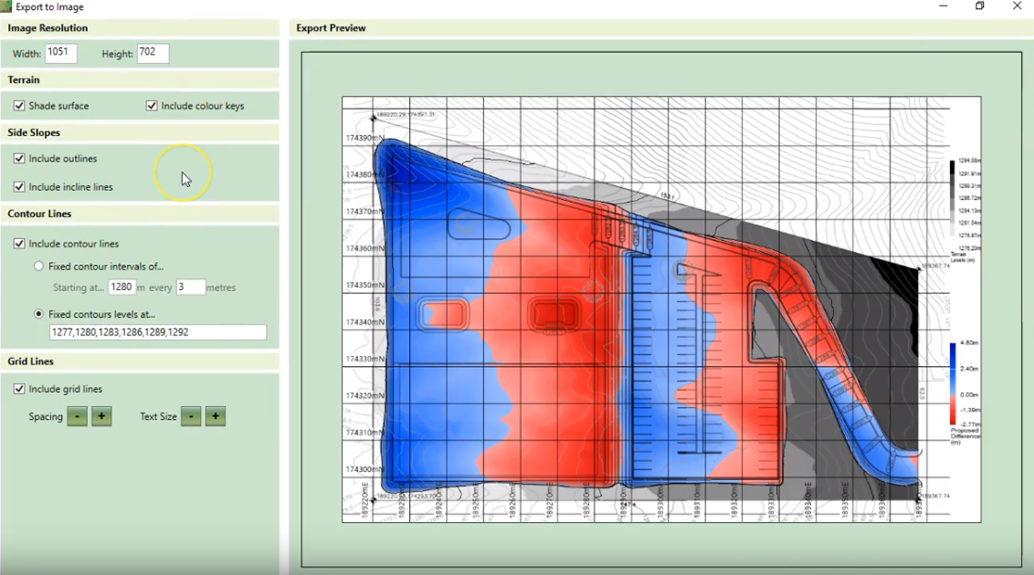
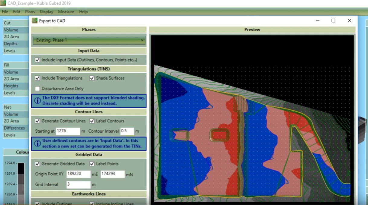
EXPORTS
Once you have finished defining your project, you may wish to share your work with others, or to import into a machine control system. You can export your project to Reports & Spreadsheets (.pdf, .docx, .xlsl), images (.jpg, .png), CAD files (.dxf, .dwg) and LandXml files (.xml). These videos overview all the options to export data from Kubla Cubed into other file formats.
Reports & Spreadsheeets
Images
CAD Files
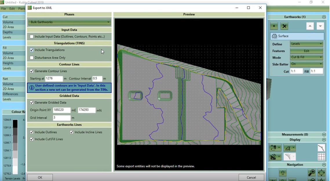
LandXml Files