Any number of water levels can be defined for the project. This functionality is typically used to define standard water levels, such as the Lowest Astronomical Tide (LAT), Highest Astronomical Tide (HAT) and Mean Sea Level (MSL).
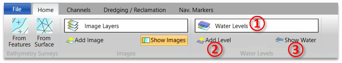
To add a water level click Add Level ② in the water levels section of the home tab. You will be prompted to type in a name, description and level relative to the project datum. Once you have done this the water level will be added and will be displayed in the drop-down list ①. From this list you can edit or delete the water levels you have defined.
The project visualiser will only show the active water level. The active water level is indicated with a tick on the water levels drop-down, and it can be changed by clicking on a different water level on the list. It is also possible to turn off the display of all water levels by toggling the Show Water ③ button in the water levels section of the home tab.